2022 11 24 McLeods Ck NR with MelbaShed
This was a 4.4Km Easy-Medium circular walk around McLeods Ck NR near Gundaroo north of Canberra in NSW. This was Melba Shed walk No 282 of 24th Nov 2022.
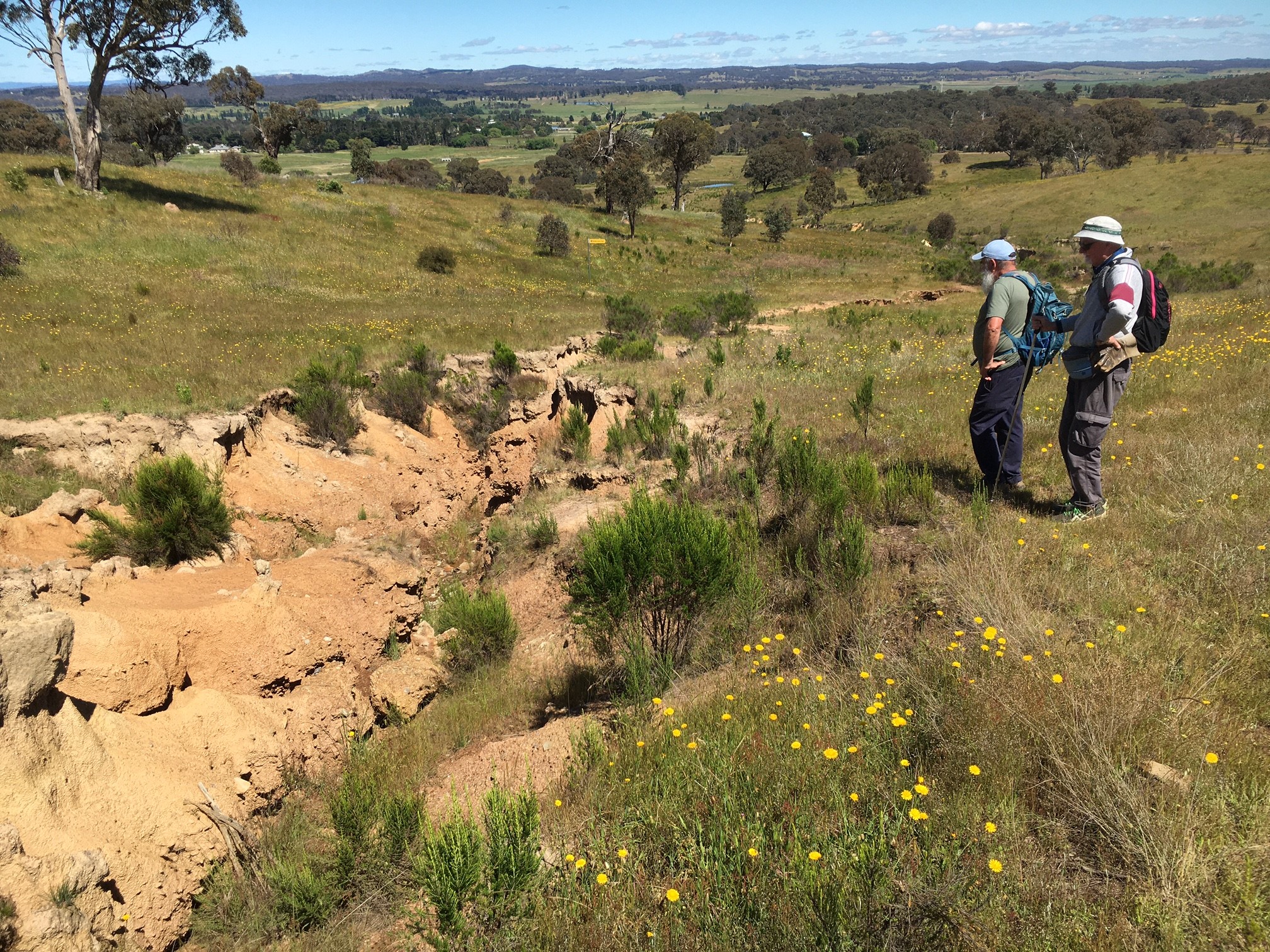
Featured image – View of 2 of the guys viewing the major erosion gully in McLeods Ck NR
I led this walk with 3 of us walking. We met at the Shed by 8AM & drove in two cars to Gundaroo via Gungahlin. The road to Gundaroo is quite pot holed and care was needed.
We went through Gundaroo & turned right onto Rosamel St and then to Marked Tree St. The later was in parlous condition with numerous damaged sections on the bitumen road. We parked along the edge of the road on some grassy sections and then walked through a locked gate & along some vague routes to head south east up hill over grassy sections.
We initially followed some old Telstra cable markers until we were on the top of a ridge line. From the top we headed south east along a ridgeline until we were at the eastern boundary fence of the NR.
We then headed back into a high gully before climbing a little to reach a south western ridgeline that gave us great views out west to Gundaroo. We then walked westerly down the edge of a large erosion gully with an old Kingswood car partially left in the gully.
We reached flatter land down near a dam and a Telstra cable marker where we turned north west to head back to the cars. We had started the walk at 8.55AM & finished it at the cars at 10.58AM thus taking 1 hr 53m for the 4.4Km walk.
Drew went home as he had to pick up his wife’s car from the repairers.
Meanwhile Harry & Greg went down to the Yass River accessible from Lot St, Gundaroo & also visited the Common & Cemetery which held people who had died from the 1800s through to 2022.
We then drove up to the Gundaroo Café & Cork St Cellars (ala PO Café) for a coffee & fish & chips.
Walkers: Drew McDonald, Harry Angel, Greg Hutchison
Drivers: Drew, Greg
This was an Easy-Medium walk of 4.4km, excluding Gundaroo sections.
We had started the walk at 8.55AM & finished it at the cars at 10.58AM thus taking 1 hr 53m for the 4.4Km walk.
Map of walk | Pictures in Google Photos | files including gps located in Google Drive
My previous recce walk to McLeods Ck NR and Gundaroo
Notes re Map: GPS Map View provided using BaseCamp on an OZtopo Map with permission of © BKK Enterprises Pty Ltd, http://www.gpsoz.com.au. The area of the walk is covered by the NSW 1:25,000 topo map HALL