
2024 07 04 &18 Ginninderry Tracks Walks
These were two easy to medium walks from The Link parking area at Strathnairn, a new suburb in western Belconnen in Canberra. I walked along what is known as the Corridor Walking Track Network.
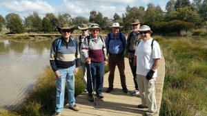
Featured Image above is a view of one of the specially built walk throughs for the area to make it easy for us humans but impossible for cattle to progress
The Corridor Walking Track Network (or Ginninderry Tracks if you like) is a set of well constructed tracks or trails that have been developed by the Ginninderry Conservation Trust to provide some exercise areas as well as preserve the beauty of this area along the Murrrumbidigee area. They have plans to extend the tracks to encapsulate the Ginninderra Falls area which lies just to the north in NSW.
The whole scheme was devised to enable several new suburbs to be provided to the west of the original Belconnen area. Only the suburb of Strathnairn has been mostly built thus far with the next suburb called Macnamara now being worked on. You can see them grooming the ground for this suburb as you walk back past Woodland Lookout. More suburbs may occur if they can acquire land in the Ginninderra Falls area.
Parking for Walks. I parked at The Link location which is at the end of McClymont Way which is accessed from Pro Hart Ave, which is itself accessed from the western end of Drake-Brockman Drive. Of course if you walked from Shepherds Lookout area you can also park down on Stockdill Drive also accessed now via Pro Hart Ave.
1. Walk on 4th July 2024. This walk was my first over this area, although I had been several times between Strathnairn and Shepherds Lookout. I walked about 7.8Km in total including a diversion to Burrin Lookout and back.

I walked down the main track initially, then turned right near the real beginning which is where one walks through a complex wooden structure designed for humans to pass through and stopping cattle from passing. I think of them as “walk throughs”. Just after the first one is a turn off for the track to Shepherds Lookout which is worth doing if you have never been there. For me I turned right to soon pass over a metal bridging crossing a heavily eroded creek gully. I continued down past a large dam then through another walk through and down to a spot where on could turn a little left and continue down to Burrin Lookout which I did. It provided great views over the Murrumbidgee Valley. From here I could have taken a track that ended at Shepherds Lookout, but I returned to the previous junction as I really wanted to get down to the Murrumbidgee as well as the swinging bridges.
So I crossed a short metal bridge and turned hard left which put me on a narrow path which has a large drop on its left. Its a good path but it has some tight spots where I had to drop down over stone steps to a lower level. There was rest spot here with a small lookout. Continuing down and then turning northwards I eventually reached Nguurung Lookout. It has a large seat that you could sit on, have a snack and enjoy the view. I ran into a guy who I first met a year or more ago in Melba Shed whilst walking. This was John Fuller who now lives in Strathnairn. He showed me the way from that spot. We simply walked a little then turned left to drop down to the level of the Bidgee Dam, then we went pas the dam through a gate and over the Swinging Bridges (shown on the official map as Suspensions Bridges. It was then uphill a little, over another metal fixed bridge then back along a higher path to the south to then turn uphill for a short steep climb to the Woodland Lookout. John pointed out some metal square that he had been involved with volunteering for the Conservation Trust who had built all the paths. We went back on the higher path initially.
We then had coffee at the Stepping Stones artists cafe just about 150m to the south west of The Link at Strathnairn. I owe John a coffee.
2. Walk on 18th July 2024. I went back to the same area two weeks later as my pictures from the first walk were no good as I had not set the selection properly on my old Panasonic Lumix Camera. That’s truely annoying when you walk somewhere, or even just drive and take a bunch of shots, and they are all defective. So I returned and took a bunch of pictures however I missed a few waypoint readings on the last part as the rubber button on my Garmin Oregon 650 GPS unit disintegrated. The tracking still worked but I could not press any button to create a waypoint. It had just disintergrated, although I could download the track OK. Strangely enough I soon received a Garmin GPS Map 66i that I had ordered from Amazon. Now I have to read John Evans guide to using the unit. They say things happen in threes. The third thing for me was my heating system failing at home. Ouch that was costly to fix but it was quickly done.

On this journey I followed much the same route back except I did the loop section over the suspension bridges in the reverse direction and I didn’t go to the Burrin Lookout and on the return I took the southern pink trail back towards the Woodland Dam rather than the alternative option to its north. After using both these links I would recommend the one I took on this second walk as it a very nice path and the views are superb. You may have to walk on 10m of grass to get good views but its worth it. There are also a couple of stone seats you can use for a rest. The path I took starts just after the Woodland Lookout, also another good view from there. There is a marker just past the lookout advising of this path.
It was a great Medium walk of 7.5km, taking about 2hrs 30 mins incl breaks.
Map of walk | Pictures in Google Photos | files including gps located in Google Drive
Notes re Map: GPS Map View provided using Mapsource on an Oztopo base NSW topo map | The area of the walk is covered by the NSW 1:25,000 topo map UMBURRA