
13-16 Nov 2001 – Trip to KNP Pilot Area – Pinch River – Ingeegoodbee – Tin Mine Huts – Cowombat – Ingeegoodbee R Vic
This was my second trip to this area, the first being in May 1978 but this time I did it anti-clockwise.
Day 1
I parked my car at the Pinch River camp area on the south side of the river and below on the flats grassy area before the side Nine Mile trail climbs up towards the Ingeegoodbee River passing through Pinch Pass on the way. It climbs from 260m at the camp site to 1200m near Pinch Gap before dropping to 1100m near Ingeegoodbee Hut. So at least 780m climb or some 2560ft. Its a relentless climb with little in the way of any flat sections.
On the way up the trail, after about 1Km along the trail after starting the big climb, I dropped my pack and followed sign of an old trail, the Charcoal Range Firetrail for a couple of hundred metres west. It was a bit dangerous as a lot of it has been washed away on a steep slope and probably was not easy to negotiate. I turned round and resumed my main climb. It was late afternoon before I reached the Ingeegoodbee Trail junction with the Nine Mile Trail. From the junction there is a trail that winds it way west for 150m to the Ingeegoodbee Hut. Its in poor condition now compared with 1978 when brumby runners were still able to use it. The it had a wooden floor and was well stocked with food and utensils. Now its pretty much a bare shell. I dropped my pack and walked around 300m down to the Ingeegoodbee River. I then returned to the hut, collected my pack and returned to the main trail and turned north.

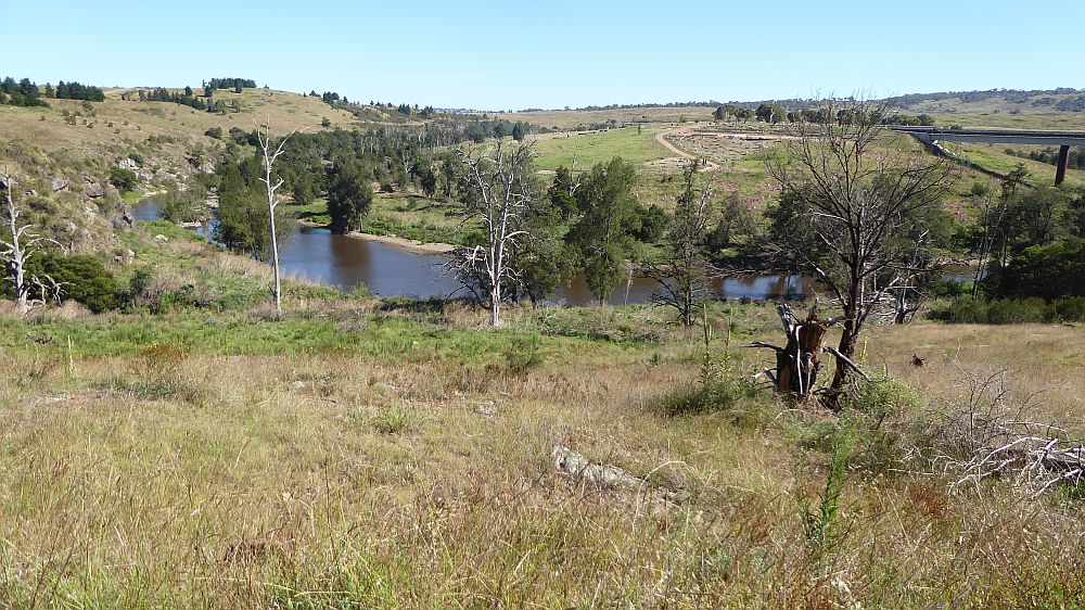
In about 400m the trail crossed the river which was flowing quite well and was deep in places. I managed to cross nearby and as it a nice open and flat area nearby I decided to camp there. Wood was plentiful as was water and it was a nice spot. Later that night I heard numerous noises caused by brumbies moving about. It was about 1040m at this site.
Day 2
This day I headed north along the Ingeegoodbee Trail which is any easy walking trail although I was still somewhat tired after the climb from yesterday. However I made the Tin Mine Huts (one hut also known as Charlie Carters Hut c1935 or Tine Mine#1) by mid afternoon. Its about 1260m here so it was over a 200m climb along the trail. The featured image at the top of this post shows the huts. I looked around and the headed south down the Cowombat Trail. Near the huts is the junction of three trails, those mentioned and the Cascade Trail which heads north to Cascade Hut and on to Deadhorse Gap, near Thedbo. Both the Cowombat and Cascade Trails now form part of the Aust Alpine Walking Trail (AAWT). There were quite a lot of brumbies around the Tin Huts area as it fairly open in spots.
I continued south and realised that I would not make Cowombat Flat before dark. I look ed quite a while for a suitable camping spot and found none. Don’t you hate that! Anyway one of the side creeks I crossed I was able to walk upstream for a 100m or so and find a small spot on which to pitch my tent. There was again plenty of wood and water although only a small trickle. During my dinner a brumby tried to come down the side of the creek. On seeing me he decided the other way was safer. Again the weather had been superb although slightly warm. I had crossed the 1400m level along this trail and the campsite was around this altitude.
Day 3
I continued down the trail continually crossing small creeks and passing my highest point of 1500m before eventually reaching the border at Cowombat Flat at about 1150m altitude. I was running late, but was able to move south on the falt and find some relics still of the RAAF DC3 plane that had crashed landed here on 24 Aug 1954. This link describes the details of the crash, the people involved. Of the 4 aircrew one died. If you look at the link you will see a picture from 1962 which shows most of the plane still there. Over the years people in 4WDs have taken out pieces. There is luckly to be any left.

I then headed east along the Macfarlane Track which climbs to around 1300m before dropping down to around 1000m as it crosses Moscow Creek. The it leaves the Cobberas Wilderness zone which keeps 4WD away from Cowombat. Quickly it joines the Cobberas Trail which is the main route to the Berrima River and its campsite. Quiet a nice spot. From the Berrima River there is the Berrima Track up to the border but I didn’t have time to check that out. I was hoping to make the Ingeegoodbee River for the night. There is a small campsite on its western banks.
Luckily I was picked up by some fishermen in their 4WD ute and they took me the last few Km to the River then across it and up a long steep spur to the Ingeegoodbee Track and then north for about 4Km to a campsite. They were camped at a site with a hut south off the Macfarlane Track just east of the river. It was at about 850m altitude.
The Ingeegoodbee River crossing was at about 550m altitude and it was quiet deep. Not sure I could have waded across. However I remember doing it in May 1978.
That night I camped and cooked in the dark at a small picnic area just over a side creek to the Ingeegoodbee River. It was OK as vehicles could not cross that side creek anymore as the Victorian parks people has blocked the Ingeegoodbee Track at that little creek crossing.
Day 4
Next morning I wandered back down to the creek and up to a small hut which I could see from the campsite. I then continued north along the trail and had to climb to 975m at the NSW/VIC border but even higher to 1100m before reaching the Nine Mile Track junction. It was then a painful climb to 1200m before passing Pinch Pass and taking the Nine Mile Trail down to the Pinch River. I then had to drop down to 260m near the Pinch River where I had left my car. Its was a painfully slow descent as the trail is quite steep and slippery. I made it OK.
Near the bottom I dropped my pack and walked along a brumby pad that had developed along the western southern side of the Pinch River. I went upstream for around 1Km checking out where it went. I deduced it continued far enough that one could connect with the old Charcoal Range Firetrail that used you connect to the Nine Mile Trail. This would a better link then trying to follow the old firetrail that I had found on day1. Overall the Charcoal Range Trail runs some 3-4km up the Pinch River before climbing up on to a ridgeline then joining the Tine Mine Trail a fair way along the Charcoal Range. However there is a big climb to 1350m at the junction with the Tine Mile Trail, then a further climb to 1600m before dropping down at the Cascade Hut to join the AAWT at 1260m. Also its hard to know how much of it is overgrown or made difficult by falling timber
Once back to the car it was time for a wash in the creek, change of clothes then head home. Once home I found out from the wife that a ranger had rung her about my abandoned car at the Pinch River. Ouch! I rang then the next morning to advise then that it was not abandoned and I was OK. From that date forward I always left a note on the dashboard explaining my route, name and contact number.