2019 03 14 Mt Wanniassa & Farrer Ridge with MelbaShed
This was a walk from Springvale Drive, MacArthur, Canberra, through Mt Wanniassa & Farrer Ridge Nature Reserves to Mt Wanniassa & Farrer Ridge, then to Erindale Shopping Centre for coffee & snacks and then back to the cars through Fadden. This was a Melba Shed walk
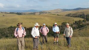
Featured image is of Greg on Mt Wanniassa
On this trip was 9 members from Melba Shed. 8 of us met at the Shed by 8AM, then drove to our parking spot on Jackie Howe Cres, MacArthur, where we met 1 more.
I found my GPS batteries were dead even though they were 100% charged the previous night. I was able to navigate the walk using maps we had printed as well as Strava on my Samsung Note 4 phone & ended up with a gpx track that could be extracted. It showed 12.7km & 2hrs 54m of moving time. This was unedited & after taking off diversions & extra track points generated in the buildings it was less.
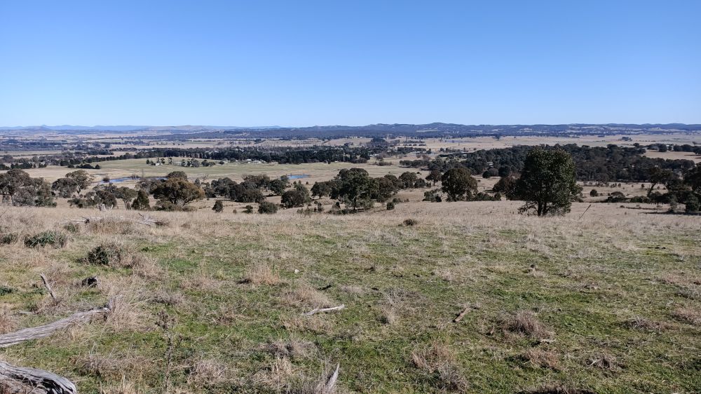
At 9.08AM we started walking a circular route up along Karralika Ridge & to Mt Wanniassa with great views over Tuggeranong, Woden & Hume. We then walked down to cross under Erindale Drive, then did a short circular walk around Farrer Ridge, although we walked along a more southerly trail than planned & missed the Main Trig site.

Then we crossed Sulwood Dr, walking down to have a late morning tea at Erindale Centre from Coffee Guru. We sat outside on a brick fence. Leaving we noticed Caffe Cherry Beans which looks like a more sensible coffee spot as Coffee Guru is right inside & quite congested.
We then continued east through Fadden & Macarthur on their urban paths & finally the Canberra Centennial Trail (CCT) back to the cars at 12.54PM.
Whilst on this last leg it started sprinkling as we left Erindale but wasn’t heavy enough for us to use any rain gear & didn’t last long. The weather was mild and overcast.
We started the walk at 9.08AM and finished at 12.54PM, thus taking 3 hrs 46mins overall. The trip was a Medium-Hard Walk, of 12.4Km.
On the way back home we took a route along the Monaro Highway and we talked so much I missed the turnoff on to Parkes Way and had to continue up the Majura Parkway until we could turn off and go back through Mitchell. The others got a free tour of nice route off the Federal Highway along Well Station Road, across through Mitchell on Standford St and back along the Gungarlin Drive and onto Ginninderra Drive.
Access to Start & Finish Parking Spot: Access was via Tuggeranong Parkway to just south of Tuggeranong, then at the large roundabout left onto Isabella Drive. Then we took the 4th intersection on the left, ie Coyne St. Then the 2nd intersection on the right, ie Jackie Howe Cres, & just after the 5th intersection we parked on the left. Its an obvious spot with signs Wanniassa Hill Canberra NR
Walkers: Bob Salmond, David Ruthven, Drew McDonald, Ian Ruthven, Neville Viney, Paul Taylor, Rob Hansen, Wally Kulesza, Greg Hutchison.
Drivers: Bob, Drew, Greg.
Map of the walk | More pictures in Google Photos | gps, gpx and GE files are located in Google Drive
Notes: GPS map view on map base using open source OSM NSW cycle map | The area of the walk is covered by the NSW 1:25,000 topo map CANBERRA.