2019 02 28 The Pinnacle & Weetangera Cemetery with MelbaShed
This was a walk from Springvale Drive, Weetangera, through The Pinnacle Nature Reserve to Weetangera Historic Cemetery, then back to the cars via The Pinnacle itself. This was a Melba Shed walk
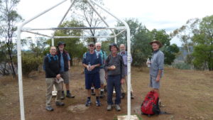
Featured image is of Greg & Guys at a Shelter others had created along a foot track in The Pinnacle Nature Reserve
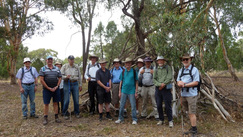
On this trip 13 members from Melba Shed walked. 9 of us met at the Shed by 8AM, then drove in 6 cars to park off Springvale Drive Hawker, about 100m before junction with DeSalis St. Here we met 4 more.
Then from 8.27AM we walked down the Valley Track before turning west on short Track, then we took a short detour up to Bunny Hill for some minor views. We then went west on a foot trail, stopping at a human made shelter, until we met the Dowling Track, then we joined the Bicentennial National Trail (BNT), following the south fenceline before taking an underpass to the historic Weetangera Methodist Cemetery with the oldest gravestone being 1875. Some of the Southwells who established the Parkwood Church were buried there.

We then returned taking the Springvale Track along the suburban fenceline until turning south on a footpad until reaching the Pinnacle peak itself. It was then a short journey to the cars which we reached at 10.59AM.
On the way near the Kama property homestead on the Dowling Track, Ted advised us that one of his uncles was a Dowling who had lived further north near the Hawker school and owned the area including the Kama property.
After the walk most of us went to the Southern Cross Club at Jamison for coffees, a milk shake and some snacks.
We started the walk at 8.27AM and finished at 10.59AM, thus taking 2 hrs 30mins. The trip was a Medium Walk, of 7.1Km.
The weather was fine, initially overcast, then sunny, no wind and not too hot at around 20-25C
Walkers: Bob Salmond, Colin Fitzpatrick, Drew McDonald, Harry Redfern, Ian Ruthven, John Marsh, Neville Viney, Paul Taylor, Peter Coppin, Rob Hansen, Ted Kell, Tony Danaro, Greg Hutchison.
Drivers: Bob, Drew, Harry, Neville, Paul, Peter Coppin, Rob, Ted, Tony D, Greg.
Map of the walk East Portion | Map of the walk West Portion | More pictures in Google Photos | gps, gpx and GE files are located in Google Drive
Notes: GPS map view on map base using open source OSM NSW cycle map | The area of the walk is covered by the NSW 1:25,000 topo maps HALL for the Cemetery and CANBERRA for The Pinnacle Nature Reserve area.
References Documents & Links: History of the Church | Info on the Cemetery | ACT Heritage Register | Friends of The Pinnacle