Tasmanian Overland Track 8-15 Nov 2014
Overland Track: Cradle Mountain to Lake St Clair. This was a 6 days and 77Km hardish walk from Ronny Ck near Cradle Mountain to Narcissus Wharf, Lake St Clair. The actual track can be done in 64.2Km if no side trips are undertaken. I have also included some pictures, maps and gps data, plus some of my personal observations.
This is posted to document an old walk for historical purposes only.
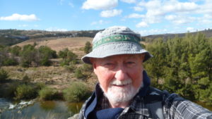
The featured image is a view of Cradle Mountain with daughter Geri and I, Greg
Personal Observations on a Walk on the most famous Tasmanian Track
Introduction
This trip was conceived by my daughter Geri, way back in 2013. She kept at it and in moment of weakness I acquiesced and agreed we should walk the Overland Track in Nov 2014. Well she set to work and organised two of her girlfriends, Rene and Tania and one parent, Trevor and one work friend, Phil to come along.
So in Aug and Oct 2014 we had a couple of planning meetings to work out our logistics and arrange ourselves into two groups for cooking purposes as well as decide on how we were going to do it: fly, catch ferry, uses buses or take some cars. Well we mostly agreed to catch the ferry and take car, except Trevor who had to fly down late.
My pictures of this trip along with some from the others are available on Google Photos
Pictures in this post are listed below. Click on these to enlarge. In order these are:
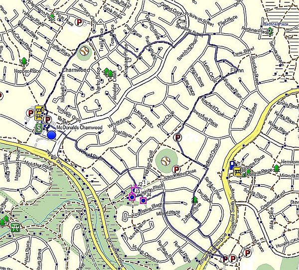
Map – Overview map of the walk
Day 1 – Climbing Ridgeline to Marions Lookout
Day 2 – View of Barn Bluff from lake Will
Day 3 – Geri in the forest
Day 4 – Mt Doris and Ossa
Day 4 – Kiora Hut
Day 6 – Lake St Clair at dusk
Day minus two – Sat 8th Nov
On Sat 8th Nov Geri and I set off from Canberra, whilst Geri’s friends Rene and Tania did the same thing, in two vehicles, Rene’s and mine. We both stopped at Holbrook for coffee at the bakery in the main street. We also stopped at McDonalds at Gundagai for early coffee and Glenrowan for lunch.
Also Phil and Heather had left Canberra three days earlier and taken the ferry across on Thursday night in Phil’s car.
We reached the Port of Melbourne in mid-afternoon, but stopped at Coles Port Melbourne for some items. Gosh the traffic was scary. We queued up in the car line around 4.45PM and then stayed in the queue for over an hour until we entered the ferry from its bow entry and drove down to Garage 5. Geri declared one 230g butane/isopropane camping gas cylinder which was labelled and we were given a ticket to reclaim it when we landed in Devonport.
We also had an e-ticket after booking on line, and going past a window they gave us a boarding pass for each person, plus the car and plastic cards for a cabin we had booked.
The weather was now blustery as a cold change had hit Melbourne mid-afternoon, after it endured a 37 degree day. The waves on the bay were being whipped to a frenzy.
Spirit of Tasmania, TT-Line Company Pty Ltd (TT-Line) is a State of Tasmania owned Company that runs the two ferries, Spirit of Tasmania I and Spirit of Tasmania II. These were built in 1998 by Kvaerner Masa-Yards in Finland. They have a displacement weight of almost 30,000 tonnes and a length of 194 metres and are 25 metres wide.
Spirit of Tasmania I and Spirit of Tasmania II cross Bass Strait at a cruising speed of 25 knots which is the equivalent of 50 kilometres per hour. The 429 kilometre voyage across Bass Strait is roughly twice the distance by road between Devonport and Strahan, on Tasmania’s west coast. The trip takes 9-11 hrs depending on conditions. They each have 748 berths, 222 cabins, and 146 seat recliners.
We boarded OK and clambered up several flights of stairs to reach our cabin 7026 on Deck 7, the main deck for passengers. It contained the café/restaurant, bar, gift shop, purser, cinema and lounge. The others had to find their recliner seats at the back of deck 8.
We dined with some trepidation at the café (The Captains Table it’s called) and ate enough with heaped small plates. The ferry left port pretty much on time and travelled right down Port Phillip Bay before hitting Bass Straight. That’s right “Bass Straight” in a howling gale!
Well we had a shower and climbed into our beds taking a couple of sea sick pills just in case. Must admit they worked great and I never saw any green visions floating past my brain before heading for the head. However I remember feeling a distinct change in ship movement as we went out into the ocean proper at about 10PM. Being a light sleeper I felt the change straight away. The ship moved around somewhat with some crashing sounds as it topped some waves and dropped into the following trough. I closed my ears to the noise and pulled the sheets over my head.
Day minus one – Sun 9th Nov
I awoke around 5AM. It was incredibly calm. I got dressed and went outside for a look and could see the north coast of Tasmania fast approaching with the lights of Burnie blazing to the west. Straight ahead was a small river leading to Devonport, East and West Devonport as it turns out. I went back and packed and had a small breakfast they provided in the café.
Then I went out and watched as we entered the port. It’s a tight entry especially for a 30,000 ton ship. As it enters the Port its only 100m from nearest houses in East Devonport. Then it pulls up next to the wharf in East Devonport, and moves sideways into its unloading birth, with cars to depart this time from the stern.
After the usual docking stuff we were allowed to drive off, being inspected by Dept. of Primary Industry people: you can’t bring fresh food or fruit into Tasmania, and then also we had to collect our gas canister. We then drove over to Eurocar and Geri picked up a hired Pajero that we were to take to Lake St Clair which would then transport us back to Cradle Mountain.
And so began probably the most difficult day of the trip in terms of logistics.
Initially we went around to the main Devonport to visit McDonalds and we purchased some coffee, and breakfast for the other two girls. Then we drove in convoy along highway 1 towards Launceston, however turning off at Deloraine and picking up Highway A5.
It was initially a nice route but then turned into a very winding and climbing route past Quamby Bluff then through the Western Tiers until breeching the top and getting a grand view of the Great Lake. The road was now straighter but dirt and of good quality. We travelled right down the western side of the lake until we turned off to the B11 Marlborough Highway through to the A10 Lyell Highway which then took us to Derwent Bridge and finally Lake St Clair.
Here we had to get park passes for the two vehicles we left there: my car and Rene’s. These varied from $40 (senior’s discount) to $60 for 3 Months pass for all parks for Rene’s car. Each covered up to 8 people in a car. We then lunched at the Derwent Bridge café, and then headed west in the Pajero to Queenstown, then onto Zeehan Highway to Rosebery, then the Murchison Highway until we could take a link road C132 across to where we picked up the road to Cradle Mountain.
We then found the Big 4 Discovery Caravan Park and were given a smelly 6 berth cabin for 1 night. Heather and Phil had arrived earlier and stayed a couple of nights in another much nicer cabin.
The 3 girls decided to all go back to Devonport with the hired Pajero which they drove to Devonport Airport, where they dropped it off and waited for Trevor to arrive from Melbourne on the late 8.20PM flight. They all then took a bus back to Cradle Mountain arriving back about 10.30PM. It ended up being a late night and overall a long day.
I had bought some tinned soup and ice cream for dessert from the park receptionist. They do sell bread, milk and various items of food. Most of the cabins have cooking facilities and showers as well as heaters. We needed to turn on the heater this night as it was cold. Compare that to Melbourne’s 37C the previous day.
This method we used of placing cars at Lake St Clair and hiring a car to take us back to Cradle Mtn apparently worked out cheaper than getting a bus back from Lake St Clair to Cradle Mountain. This is one of the issues with the Overland Track: no easy way between the start and finish for vehicles.
Day 1 – Mon 10th Nov
This was our first real day walking. We arose around 6.15AM. As we were getting ready to leave we found that Geri’s bladder located on top of her pack had leaked and wet quite a bit of her gear. So she had to take some gear out and dry it later and ensure the bladder was sealed properly.
We all put our spare items from the previous day into individual duffel bags or similar and placed them into Phil’s car. Heather then drove it to Derwent Bridge where she stayed for 5 nights alone.
We all then walked down to the National Park Centre which was only 200m from the reception at the Caravan Park. We then registered and received our walking passes which we had paid for on the web previously.
We then took a free shuttle bus from outside the centre up to Ronny Creek Car Park where the Overland Track officially starts. We started walking from here around 10AM.
Initially the first Km is across a wide plain until it starts to climb up alongside Cradle Creek for another Km or so, until it reaches Cradle Lake. This is a beautiful spot with large hills and mountains all around. However you soon are climbing again until you reach a spot where tracks join and you get a great view of Dove Lake to the east.
On this occasion the wind had built up so much I had to stop and put on my raincoat to act as a wind break and it was hard standing still. The wind was ferocious.
It was then a steep climb up a sharp ridgeline with steps, chains and rocks to reach Marion’s Lookout which offered superb views to the north and east and south to Cradle Mountain. Unfortunately the savage wind made it quite unpleasant.

We punched on with occasional rain showers and reaching a peak of about 1,250 m before heading down slightly to reach Kitchen Hut. Here we lunched sharing a small cramped hut with several others. I remember one Japanese Girl and her Taiwanese boyfriend were going on after lunch to climb Cradle Mountain which was in mist and pounded by an incredible wind. It did not feel like a safe option at the time. Apparently it’s not that hard a climb.
Anyway after my Mountain bread cheese and peanut butter and honey lunch we moved on and took the track along the western side of Cradle Mountain. It was a constant battle against the wind and also the large rocks that tended to be along the route the track took.
As we reached the southern end of Cradle Mountain, there was a junction to Scott-Kilvert Hut. Apparently it is a nice hut and little used. David Scott (Historian) told me later if walking in this area he and his wife leave their car at Dove Lake and take a path east of Dove Lake and spend the first night at Scott-Kilvert Hut. This avoids staying at Waterfall which tends to get congested in peak periods.
Leaving the junction it’s then a straight walk along narrow boards to another junction that leads to Barn Bluff. This is an amazing peak and dominates the walk for the first couple of days. It an impressive isolated peak. Apparently it’s harder to reach the top and is suggested only for experienced walkers which some climbing skills. From the junction it’s an easy walk on boards and then down steps into a valley before reaching Waterfall Hut. In the wind it was not so easy to stay on the boards and I distinctly remember constantly over adjusting for the wind and having to put one foot onto the grass on the side.
We reached the new hut second with only a lady and her daughter in occupation. The hut is similar to Kia Ora in a way and has four bunks offset against a central cooking area. The bunks are in two layers and opposite each other. So each bunk or layer is supposed to serve 5 people side by side (maybe 6 at a squeeze). The hut can accommodate 20 easily. Another 4-6 could sleep on the floor if required.
The heater is one of those LPG things with a timer and a thermostat so that it can’t be started unless the temperature drops below 10C. Well it did in the morning, I think it was 0-2C and we still couldn’t start the thing. These heaters are not easy to comprehend and possibly with various people fiddling with them may be dangerous. Is anyone listening!
Well we cooked in our two groups. Geri, Phil and I in one and Rene, Tania and Trevor in the other group. We started with individual cup of soups, then we cooked a 2 person freeze-dried pack plus an entrée freeze dried pack of the same flavour and we added some potato powder and a little couscous for bulking it up a little. We had boiled around 500-600ml first in Geri’s pot and then added the freeze dried ingredients, and then left the pot with lid on for 10mins. (if it’s really cold and you do this you can restart the stove to reheat as required). We then dished it out to our plates and enjoyed. Washing up in this configuration is harder. Its best to boil some more water (rinse out the pot first) add a little bio-detergent and wash plates etc out under tap where any waste and waste water can be deposited as well as then rinsed. But this was not easy in the violent cold weather which it was now. Any uneaten solids have to be deposited into the toilet. This is a job most hated and I avoided.
Before dinner I visited, as did some of the others the Old Waterfall Hut, where several people, around 6 I think, decided to stay. It’s nominally only for 4 people but again more can be accommodated. It’s about 150m directly west of the new hut, all on boardwalks. In front of this hut is a grassy, but slightly bumpy area on which you can pitch a tent. Highly recommended in good weather. However in our conditions no one put up a tent.
There are several Bennett’s Wallabies that seem to live in the area and you can see them grazing between the two huts.
Several people kept coming into the hut fairly late in the day. So a hut that was spacious soon became quite busy. Last in just before dark at 7.30PM was a guy from Trevor’s past whom he knew from early days in the Army Reserve. This was Scotsman Alan Stewart, now a renowned mountaineer; a Sydney resident now with his neighbour John. Unfortunately John had not been equipped for the cold windy weather and was suffering from a dose of hypothermia. Alan put him to bed in his sleeping bag. He recovered over night and was fine in the morning. Phew!
All night it blew quite ferociously but by morning it was much calmer with less cloud and hints of sunshine.
Today we did 11.6Km. However I clocked up 12.2Km on the GPS with some walking around Waterfall Hut including to the Old hut and back.
Day 2 Tue 11th Nov
We awoke around 6.15AM and after breakfast and packing up I left around 9.10AM ahead of the others who left at 9.25AM.
I dropped my pack and went down a rough track to check out some of the Brannigan Falls. Phil was with me but decided to stay on the main track. There was an upper small falls with a large ledge and large drop down for the lower falls. I went down and under these falls which you can get behind as the ledge is undercut. The falls are on the Hartnett Rivulet. Apparently the largest falls of 60m are further downstream from where I went. I returned to the pack and headed off with Phil around 9.40AM.
Not far along the track, near here there is a private lodge way up on a ridge to the west and also near here along on the east was the old Cirque Hut which must have been there in 1978 when I last visited. According to search on the web Cirque Hut was built in 1969, and was removed in 1993 because of snow creep according to KHA.

We were soon met by the others and walked on to the junction with the Lake Will Track. Here we dropped our packs and several of us started but once they saw the lake a couple turned back leaving Phil, Geri and I to make the lake’s first small beach. It’s quite a large nice lake dominated at the north end by Barn Bluff. Phil and Geri then turned back. I went onto a 2nd small beach and then left it to try and make the larger beach that takes you down to the falls at the south end of the lake. However I hadn’t put on my gaiters and the mud started to become fairly thick, so I stopped and turned back. Near the junction you pass sign of old disturbance which apparently are signs of an old coal mine.
We continued on walking across a wide open plateau with excellent views north and south.
We reached Windermere Hut around 1PM. It is roughly 500m south of the lake. There is a small access point as you pass the edge of the lake were you can actually get into the lake and swim if you desire. Burr! It was not quite swimming weather.
You can’t camp anywhere closer than 100m from the lake. There are a couple of spots each side of the track where you could pitch a tent around halfway between the lake and the hut.
I pitched my tent on one of the platforms near the hut and so did the Melbourne group which pitched two tents on 2 platforms near me. I found the process of staying the tent to either the wire ropes that are provided quite tricky as of course they are never in the right place and tightening the wire through sleeves is hard work. I found it easier to tie down my fly using small pieces of 3mm rope I brought to flat head nails along the edge of the platform.
I found using my Sierra Profile 3 mattress on the platform also not so comfortable. It just did blow up enough to give me adequate cushioning. However on grass it has always been fine. In the huts I had the same problem as the beds are largely some form of solid particle board wood.
However sleeping outside is much quieter than the snoring and constant movement and squeaking of air bed as people tossed and turned. More on that later.
We had an easy afternoon with some of the girls massaging their weary leg muscles, walking down to the lake and watching the Bennetts Wallabies and the Pademelon.
For dinner it was more of the same as last night. The hut was not totally full as 5 of us slept outside but was still well occupied.
Today we did 7.7Km. However I clocked up 12.1Km on the GPS with some walking to Brannigan Falls, Lake Will and around several platforms at Windermere Hut.
Day 3 Wed 12th Nov
We arose at 6.25AM and we left around 8.30AM. Earlier on north of the Forth Valley Lookout we were able to get Telstra Mobile reception and make some phone and text calls. This was to be the longest day at about 15.5Km. We started at about 1000m altitude and by the time we stopped for lunch at Frog Flats around 1.30PM we were at 740m the low point for the day.
There are a couple of camping spots on grass around Frog Flat with the river Forth between. Each side of Frog Flat it is a mixture of tree roots, culverts and mud to be negotiated. The climb after lunch up to around 900m was hard work and as it flattened out closer to Pelion Hut, it became easier, flatter and more modern boards appeared. It seemed like they were doing a lot of board work along here and you could see various piles of wood that had been dropped by chopper.

It was tiring work so arriving at the hut last was no disgrace. I was able to then go back and check out the Old Pelion Hut and even go further north to the copper mine which is about 300m north of the old Hut over some quite muddy patches. On the way back I went down to Douglas creek and washed my merino undershirt and my face and upper body. The creek is quite rocky and gorge like here and it’s hard to get to the water. I was concerned if I fell in I would not be able to climb out. I think I heard from someone (might have been Alan who has walked the Overland 22 times) that there is easier access slightly further downstream.
Apparently there used to be a suspension bridge here that led to the Forth River Track. Also from the new hut to Mt Oakleigh there is a suspension bridge across the same creek but we missed seeing that. However we made up for it on the last day at the Narcissus River. The old hut is sleepable in but only for 4 persons. There is a small camping spot around 50m to the NW.
The new hut is quite nice with six rooms of 6 bunks with some rooms interconnected and then accessing the main dining hall which has 5 eating tables and tables along the wall. It’s nice to sit out on the verandah and watch the sun set over Mt Oakleigh. The Bennetts Wallabies are also quite tame. I noticed one of them eating seeds of a flower on one of the small shrubs. Geri was feeling not so good as it appeared that her Achilles tendon was quite sore. I think she was worried that it was her ankle operation playing up. However the tendon seemed a lot better in the morning and she went well.
We noticed two rangers walk past the hut going to the river. There was a ranger hut several hundred meters up the main track from the hut. However he didn’t visit us in the public hut.
Today we did 15.6Km. However I clocked up 19.3Km on the GPS with some walking to Old Pelion Hut, the Copper Mine and Douglas Ck.
Day 4 Thu 13th Nov
Arose again at 6.20AM and left by about 8.30AM. Its quite a climb up from 900m to around 1120m at Pelion Gap where there is a large platform on which you can leave you packs whilst you assault Pelion East or Mt Ossa to the west. Pelion is the easiest but Mt Ossa is the highest peak in Tasmania at 1617.
On the way up I visited some lovely cascades with Alan and John which provide a good rest stop. Thus I was last to the top and being older I had to stop and rest a couple of more times. I was also carrying some of the daughters gear.

After the gap there are superb views of Ossa to the west and impressive peaks to the South and South east.
You drop down to 850m as you approach Kia Ora Hut which we reached about 12.30PM and we then had lunch outside on an open area with a table.
After lunch Phil and I went for a walk down the south side of the river around 150m and got a good view of some small falls. Apparently the main Kia Ora falls are further downstream around 500-600m but we didn’t feel like a scrub bash to see them so we just had an easy afternoon reading and resting.
The weather started to look bad in the late afternoon with dark clouds streaming over and the ranger who has now turned up predicted rain overnight. The ranger stayed in his own room attached to the hut.
Well it did rain overnight and persisted lightly into the morning.
That night we had freeze dried Cottage Pie, plus some potato powder and parmesan cheese.
Today we did 8.7Km. However I clocked up 9.9Km on the GPS with some walking to waterfalls and exploring some of the camping platforms.
Day 5 Fri 14th Nov
I got up before the rest at 6AM and visited the toilet in a hurry. I had diarrhoea. Damn. So I had a cup of coffee for breakfast and nothing else. I also took two Imodium Tablets and 2 Panadeine Tabs. It must have worked as I never went to the toilet again that day.

We got going in light drizzle about 9AM through quite nice rain forest to Du Cane Hut which was at 930m and which we reached at 10.05AM. I stopped for a while and read some of the history and spoke to a couple of the people on the private expensive guided tour. They were quite nice people enjoying their trip. The lady was a lawyer and the man a mining engineer.
We went on through more rainforest which was quite beautiful until reaching the junction to DÁlton and Ferguson falls. We dropped our packs here and went on down to view the D’Álton Falls which proved to be quite spectacular.
Returning to the packs we continued up the slippery rainforest trail until reaching the junction to the Hartnett Falls. My fellow travellers decided not to stop. Not sure what the hurry was, but even with suspect tummy, I left my pack and headed down to the Mersey River on which all these falls are located. There were others ahead as their packs were at the junction.
It was scrubbier and muddy but quite passable. You have to be careful as you approach the river as you can quickly end up right on a precipitous drop into the gorge. The falls are also spectacular but harder to see from the top. There is a continuing track down the west side of the river to the bottom of the falls after which you can go along some of the river bank to view the falls. Now Tasmania’s highest waterfall is the 104m high Montezuma Falls, near Rosebery. I know this as I asked the private group’s guide who happened to be nearby. I decline the latter extension and returned to my pack.
I was now getting quite tired having eaten nothing today. So I went on for 400m then found a trunk to sit on and had lunch about 1PM. There was a likely campsite near here as well. Lunch was 1 slice of mountain bread with some cheese and peanut butter and honey and a few raisins and nuts washed down with Tassie natural water. Yes I was drinking water from the creeks being careful not to choose any below campsite or toilet location. We were mostly using water from the hut tanks which was then cured with Katadyn Micropur Forte Water purifier tablets. However I was filling my water bottle from local creeks as we passed and in general this was quite OK.
After lunch it was a slow hard slog up a rocky and partially boards route to Du Cane Gap which is at 1070m. On the way up I passed several campsites along Campfire Creek, probably no longer aptly named. More on that later.
After reaching this gap I started to recover as it was now all downhill and I reached Bert Nicholls Hut at Windy Gap at about 3.10PM. There is a nice new rangers hut on the east just before the walkers hut. To the west of our hut you can see the private hut through the trees. No idea where the track is to get there. I had asked the nice girl guiding the walking if I could visit and have a shower. She showed no pity, but I thought a visit to see the hut would be nice.
This had been a tough day because of the sickness, side trip and that damn Du Can Gap. There numerous tree roots, rocks and mud to avoid.
The views of the Acropolis Massif from Bert Nicholls Hut are stunning. The hut was built in 2008 and whilst modern has many issues. The bunk rooms are quite dark with little natural light, the toilets are too far away on a boardwalk. The tank outside the kitchen south door could have been placed better, there is a solar powered LED in one of the corridors but lights in the kitchen were not working. The hut has so much potential but lacks integrated functional planning. The gas heater on the wall was hard to get going and thus quite unsuitable. Again it could be the source of an accident.
We shouldn’t be too critical, but imagine that kitchen filled with younger gung-ho people all thinking they know how to get the heater going.
As usual we went to bed fairly early and by 9PM. A couple like Rene and I read our Kindles with lights in bed. I found my Kindle paperwhite excellent as I could read without any other light source. I did eat dinner with the others and had no further stomach issues.
Today we did 10.1Km on the main trail. However I clocked up 12.8Km on the GPS with extra walking to D’Alton and Hartnett Falls.
Day 6 Sat 15th Nov
Arose at 6.30AM and we left the hut at about 8.50AM. The last day was the easiest with little climbing and little mud. It was mostly on solid earth with some rocky bits. Sections near Narcissus had some boards.
It was obvious that some of the area walked had been mined in the past as you could see where some of the creeks had been lined with board and or rocks. We also passed the turnoff to Pine Valley.
As we crossed Narcissus River we all had to take turns crossing the one person at a time suspension bridge. Lot of giggles and pictures.
We reached Narcissus Hut at 12.15PM and the Ferry Wharf at 12.40PM. The ferry picked us up at about 1PM and we reached Cynthia Bay Wharf at about 1.30PM. Geri rang the ferry from the hut and rebooked our trip from 3PM to 1PM which fitted in well with the others around and our timings.
There was German girl there who was going down the trail to near Lake St Clair, then taking a loop trail up to Mt Rufus and back. She was doing this alone and had also climbed Mt Ossa by herself. Some of the younger people were quite adventurous. Well I can’t say anything as I did the whole trail by myself in 1978.
The ferry trip down the lake was quite good with excellent views both sides. At the Lake St Clair wharf we had to wander up the path for several hundred metres until we reached the Park Centre with the Cradle Mountain Lodge and Restaurant attached. We signed off our trip in the book and booked into the 4 shared cabins we had pre-booked. We had some issues with location of the cabins and sharing beds etc but it was sorted out in the end.
I was the lucky one to have a cabin to myself with a connecting door though to Phil and Heather’s cabin. However they had the TV and I did not. I was happy to read my Kindle. I was able to shower and then go and do some washing in one of the laundries but I had to get a key from reception and buy some soap power. Luckily I had enough dollar coins in the car as they had run out of coins to use the laundry.

Around 6-7PM we wandered over on foot to the main restaurant and had dinner. I think I had a burger with salad. Those who wanted Fish & Chips well had to put up with Fish and More Salad. They had no spuds, thus NO CHIPS. One wonders for the prices we paid and supposedly a decent tourist location why they could have at least the basics in foodstuff and adequate $1 coins for the laundry. What do you need to do after 6 days walking? Yep wash the body and the clothes.
We also had the odd drink or two. I think the others had wine or milk shakes. I had two pints (think they were NSW schooners) which went down just sooo well!
Another issue is the poor reception for Vodafone and Optus. You really needed Telstra phone here. However sitting outside my cabin in the freezing and fading light I was able to log onto Optus and browse the web whilst 2 Bennetts wallabies squawked below me. In the cabin I had no reception.
Today we did 10.5Km to the ferry. However I clocked up 10.8Km with some minor deviations.
Distances
Distances per day with any detours shown separately:
| Day | Overland Track (km) (Parks Tas km in brackets) | Total Walked my me (km) | Road/Ferry Km not walked |
| Rd from Discovery Park to Ronny Ck | 7.9 | ||
| 1. Ronny Ck – Waterfall Hut | 11.6 (10.7) | 12.2 | |
| 2. Waterfall Hut – Windermere Hut | 7.7 (7.8) | 12.1 | |
| 3. Windermere Hut – Pelion Hut | 15.6 (16.8) | 19.3 | |
| 4. Pelion Hut – Kia Ora Hut | 8.7 (8.6) | 9.9 | |
| 5. Kia Ora Hut – Bert Nicholls Hut | 10.1 (9.6) | 12.8 | |
| 6. Bert Nicholls Hut – Narcissus Wharf | 10.5 (9.0) | 10.8 | |
| Total | 64.2 | 77.1 |
Return Journey
The next morning 16th Nov, we went to the Lodge Restaurant for breakfast and afterwards we all went our ways.
Phil and Heather went towards Hobart and were staying at Norfolk for the next 5 days.
Geri, my daughter, the other girls and Trevor went west again in Rene’s car and up the west coast to Burnie, then across to the west and down to Arthur River for the night. The next day they went up to Stanley and then eventually across to Devonport, taking the ferry back to Melbourne on the night of Monday 17th and reaching Canberra on the 18th.
I went in the same direction as Phil and Heather but continued on to Hobart, booking into a motel at Sandy Bay.
That afternoon I visited an acquaintance who lived in West Hobart (David Scott) high up on a hill and we talked about more investigation of old sites in Kosciuszko National Park. I also visited a distant relative that night and she gave me information on some contacts on Bruny Island which I stayed at for the next three days
I returned from Bruny Island on Thursday 20th Nov staying at Sandy Bay again and at midday on Fri 21st I drove directly to Devonport to catch the ferry on that night.
I again had booked a cabin, 7018 not far from the one I used coming down to Tasmania. The ship moved away from Devonport with great speed and docked in Port Melbourne at 6.30AM right on time.
I had flattened the battery waiting in the queue in Devonport and had to get a boost from the staff to start the car. Next morning it started first go. Go figger!
I was on the road at 7AM, and went west under the Westgate freeway and joined it briefly before taking the M2 north, then the M80 Western Ringroad, then onto the M31 (Hume Highway) reaching Canberra around 3.30PM.
Observations
Whilst the Overland Track is a wonderland journey it has now been turned into a tourist trip and targeted at people who are happy to pay $200 plus park fees $30 or car fees if required plus $40 for the ferry as well as stay in huts or pitch tents on wooden platforms.
I can see where so many people are thrown together it is necessary to control numbers, charge something to maintain the huts and track and prohibit camp fires which are a feature of so much camping in Australia. The marketing is clearly risk averse as everyone is supposed to carry a tent, a stove, adequate food, and sterilise water.
Sleeping in the huts is adequate but can be hard on light sleepers like me. So many people placed nearly side by side makes for lots of noise through movement such as tossing and turning and those needing midnight strolls as well as those snoring.
I found even with a quality Sierra Prolite 3 inflating mattress the wooden boards we slept on too hard. I think my mattress would not inflate enough. I also found the same sleeping on the platforms. However my mattress is fine sleeping on snow or cold grassy ground in the Snowy Mountains. There is certainly a benefit not have to pitch a tent or carry a wet tent the next day. However a tent can be a lot quieter than in the huts.
The wooden boards are I guess required to protect the track and environment from so many heavy footed walkers and this track gets a lot. I found the boards hard on my feet and developed some very sore toes under one foot. However I finished the walk with the toes OK. I must admit I find a grassy or even dirt track a lot softer than the boards. Some of the boards were actually two boards placed long wise meaning the path was quite narrow and I found myself slipping off the side at times, especially day 1 in extreme windy conditions.
Not all follow the rules. I found out later that one French girl, carried no stove and lived on cold muesli. Sad really as we carried too much gas and could have given her lots of hot water. The same girl also apparently carried no tent. No wonder some of them were so fast and agile. Clearly the parks people are not vetting every walker adequately.
Some of the Parks Tasmania and instructions were poor. Transport details between Devonport and Cradle Mountain and the latter and Lake St Clair are poor. Information on buying gas canisters or carry them on the ferry was also poor and wrong. Yes you can carry gas on the ferry if the canister is new and has not been used. Some of this is quite simple and should be available.
They also go overboard with sterilising water. Sure around very popular areas one needs to be careful, but Tasmania prides itself on clean pure water and most of the water along the track is safe to drink without purifying. The same applies to the Snowy Mountains and vast sections of the Blue Mountains Parks. Yet all this risk averse stuff and probably insurance and legal issues means Parks Tasmania is telling walkers not the full story. Its just plain wrong. The experienced Australian walkers I talked also knew this.
Cooking Needs
I think we assessed our food needs quite well, although I ended up with 2 spare couscous packets, one large noodle packet, a single serve freeze packet and quite a few tea bags. I was short of mountain bread but not having lunch on day 6 made it OK. I also ended up with one spare breakfast which I took to Hobart and used one morning.
For three people we brought 4 x 230g gas canisters. We actually used only 1 and 2/3 canisters. Geri didn’t use much hot water for tea/coffee or washing, although Phil and Geri did have deserts. So 2 canisters and 1 spare would have been adequate. In the preparation I had assessed that a single 230g Butane-Isopropane Cylinder could boil 40 x 200ml cups of water, ie 8 Litres. But I based this on an MSR Pocket Rocket with a billy. It appears that using a similar burner but with a pot with larger base area and mostly inside a hut is much more efficient.
Food Used
I used my own home made muesli mixture for breakfast and nothing else. This largely consisted of one cup in a plastic bag (freezer bag) of oats, wheat germ, barley flakes, millet flakes, some commercial muesli, plus raw sugar and powered milk (actually powdered soy milk).
For lunch I took one packet of Mountain Bread (8 pieces) and added pre-packaged cheese cubes, vegemite from a tube plus some peanut butter and honey mixture in a small plastic bottle
I also drank coffee and tea. Some instant coffee but I am now engaged with Robert Timms Italian Expresso coffee bags.
We used two person freeze-dried packs supplemented with an entree freeze-dried packet and some couscous and/or potato power.
The Back Country packets for 2 weigh 175gm. We chose one Beef and Pasta Hot Pot and one Cottage Pie
We also bought Outdoor Gourmet Company’s freeze dried packets which weigh 190gm for a double serve: Venison Casarecce with White Wine Sauce; Mediterranean Lamb with Black Olives and Wild Mushrooms and Lamb Risotto. We also bought the corresponding entree packet for each of these which weighed 75gms each.
We bought all these from Traveluniverse. The others also bought some freeze fried deserts such as apple pie and apricot crumble.
The Outdoor Gourmet Company – My reading of the product is that it is made by Back Country Foods of Invercargill NZ for Sea to Summit of Perth.
I also carried some munchy bars mostly the Wallaby Yoghurt bars (not available anymore) as well as some Coles Trail Mix.
I drank water a lot mostly from the local streams. In the high country its usually quite fine to drink straight. Just make sure what’s upstream.
Snakes and Leeches
We did not see any snakes in our groups but several of the others saw Tigers Snakes near the track. Heather also saw one near the camping ground at Lake St Clair.
Geri and I had one leech each on the lower leg which we simple brushed off with a stick. It left a small bleeding spot but it soon cleared. Trevor had one on his boot which was also brushed off. Rene who was disliked leeches and told us so in so many word never had one. Ironic isn’t it.
Tasmania only has 3 snakes, all venomous. The Tiger Snake (it is usually black and commonly called a Black Snake), the Lowland Copperhead and White Lipped Snake (commonly called a Whip Snake)
The Tiger Snake is common in the Overland Walk and usually black, although some with yellow/orange or grey band may occur as well a pale yellow belly.
The Lowland Copperhead colour ranges from slate grey or black to coppery red-brown through to deep brick-red on the upper surface. It is usually yellow-white underneath. Most adult Copperheads have a orange/red to brown streak running along the lower sides of the body. Some people mistake these as a Red-bellied black snake which don’t exist in Tasmania. It usually lives at altitudes <1000m and likes swampy ground. The Highland/Alpine variety is common in the Snowy Mountains but is slate grey or black with a light yellow streak underneath but they live up to 2000m.
Whip snakes are dark olive green to a green-grey on the back with a pale grey underneath. They are quite small and typically around a foot or 30cm. They are also common in the Snowy Mountains.
Costs
We had pay to pay $200 each to walk the Overland Track, although Trevor and I paid only $160 each as seniors. We also had to pay $40 each for the ferry along Lake St Clair.
There were also car passes we had to pay varying from $30.20 concession to $60
Other transport costs have to be factored in such as cost of hiring a Pajero for one day to preposition cars at Lake St Clair, costs of diesel for same, plus costs of the bus from Devonport Airport to Cradle Mountain.
There was also accommodation costs at Cradle Mountain for cabins at Discovery Park, and we rented 4 luxury cabins at Cradle Mountain Lodge.
Then there was the costs of equipment, food, gas, gaiters, and whatever else the other bought.
Other Peoples Information
David Nobles blog on Overland Track April 2014 – Some fantastic photos
David Nobles blog on The Falls and Du Cane Range
Relevant Topographic Maps
GPS Note – I used UTM readings with Eastings and Northings. These are the accepted format for bushwalkers as you can directly relate the figures with co-ordinates on the latest 1:25,000 map series which use datum GDA94. This is close enough to WGS84 which is what you need to set most GPS units to.
The topographic maps covering the area of this trip are 1:25,0000 newer maps from Tasmanian Govt. However for the Overland Track such maps are not really required unless your intending to do it in bad weather including winter when it snows. However for safety a GPS with appropriate maps is useful. The simplest is a Garmin Oregon 600/700 using Oztopo maps from GPSOz.
I strongly recommend that keen walkers check out the use of Oziexplorer from Des Newman’s OziExplorer plus OzRaster from GPSOz. You get can a digital raster set of topographic maps from GPSOz for Tasmania but they are expensive at $299. You could use this on an Android device running Oziexplorer, $130. I have used them only on a Windows PC to enable planning and post walk documentation.
Use of Oziexplorer with OzRaster maps enables you to load up a gpx file and see your route (and ones available of this trip) on a modern topo map base.
My GPS map extracts are about 1600 pixels wide. These maps can be seen at the end of the photos or in the Google drive folder. They use the GPSOz Tasmanian maps as a base. I carried a Garmin Oregon 650 GPS with Oztopo V5 installed on a 4GB SD card. I then downloaded Gpx files and manipulated and cleaned them using Garmin Mapsource and then saved the work to another gpx file and imported that into Oziexplorer with Ozraster Tasmania loaded as the mapping. I used IrfanView to make screen captures of the relevant area and resize as required.
I had previously used Oziexplorer’s Mapmerge program to make a new map of the relevant areas covered by the Overland track in order to have a continuous topo base under Oziexplorer.
My Map Diagrams and Pictures Available
Shared Google Drive folder with gpx, gdb, kml and map jpg files.
My pictures (all 237 of them) of this trip along with some from the others are available on Google Photos. The original pictures are mostly ~4320 x 2432, 16:9, 10.5 Megapixels, ~ 5Mbytes.
Produced Maps
Overview Maps-
- Overall Trip “OverlandTk Overview.jpg” is an overview Map of 6 Days Trip using Oziexplorer and Aust 1:250,000 topo details with various colours for each day and the boat trip
Day and Detailed Maps-
- Day 1a – “OverlandTk Day1a.jpg” in BLACK track colour covering bus trip from Park HQ to Ronny Ck
- Day 1b – “OverlandTk Day1b.jpg” in RED track colour covering trip from Ronny Ck to Kitchen Hut
- Day 1c – “OverlandTk Day1c.jpg” in RED track colour covering trip from Kitchen Hut to Watefrall Hut
- Day 2a – “OverlandTk Day2a.jpg” in BLUE track colour covering trip from Waterfall Hut to Lake Will
- Day 2b – “OverlandTk Day2b.jpg” in BLUE track colour covering trip from Lake Will to Windermere Hut
- Day 3a – “OverlandTk Day3a.jpg” in PURPLE track colour covering trip from Windermere Hut to turnoff to Private Hut
- Day 3b – “OverlandTk Day3b.jpg” in PURPLE track colour covering trip from turnoff to Private Hut to Pelion Hut
- Day 4a – “OverlandTk Day4a.jpg” in DARK CYAN track colour covering trip from Pelion Hut to Pelion Gap
- Day 4b – “OverlandTk Day4b.jpg” in DARK CYAN track colour covering trip from Pelion Gap to Kiora Hut
- Day 5a – “OverlandTk Day5a.jpg” in RED track colour covering trip from Kiora Hut to DuCane Gap
- Day 5b – “OverlandTk Day5b.jpg” in RED track colour covering trip from DuCane Gap to Bert Nicholls Hut, then Day 6 DARK CYAN to Campsite 9
- Day 6a – “OverlandTk Day6a.jpg” in DARK CYAN track colour covering trip from Campsite 9 to Junction to Pine Valley
- Day 6c – “OverlandTk Day6c.jpg” in BLACK track colour covering trip from Narcissus Ferry Jetty to Lake St Clair Jett
Notes: Map extracts came from Oziexplorer using Oztopo permission to use their Ozraster 1;25,000 map product
Other Info
Before heading out anyone should read thoroughly Tasmanian Government Information
The official Cradle Mountain-Lake St Clair map and notes is a 1:100,000 TASMAP paper map. TASMAP Products including paper & digital maps can be found here.
Tasmanian Government Relevant 1:25,0000 newer topographic paper maps are:-
- Pencil Pine – cover from Ronny Ck north to Caravan park, Visitors Centre and to the Junction of the Cradel Mountain Rd with Road C132 (not really needed)
- Cradle – covers the area from Ronny Creek to Waterfall Hut and Barn Bluff
- Will – covers from Barn Bluff to Windermere and Pine Forest Moor, Pelion Ck
- Achilles – covers from Pelion Ck, to Old Pelion Hut, and south to top of Mt Ossa
- Cathedral – covers from Pelion Hut to Kiora Hut and DuCane Hut
- Du Cane – covers from D’Alton Falls to Du Can Gap to south of the Pine Valley Junction
- Olympus – covers south of the Pine Valley Junction near the Narcissus River Suspension bridge to Narcissus Hut and further south past Echo Point Hut
Greg Hutchison, updated 15 Jan 2019