2019 08 29 Harrison Walk with MelbaShed
This was a 6.4Km walk taking 2hrs 34 mins with Melba Shed around the suburb of Harrison in Gungahlin town area, in Canberra, Australia. This was Melba Shed walk No 212.
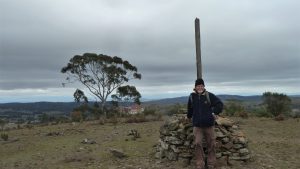
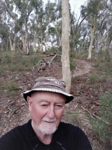
Featured image is of Greg on Old Wells Station Track in Harrison. Note reflections in the glasses
I led this walk with 7 walking on an end of winter’s day, with nice sunshine and light breezes.
7 of us met at the Shed by 8.30AM & drove in two cars to park at the Car Park for the Playing Fields on Nullarbor Ave just past the Harrison Public School. We took what was thought as the best route i.e. up the Gungahlin Drive from Ginninderra Dr, right into Well Station Dr, then left into Hoskins St, then right into Oodgeroo Ave, then right into Nullarbor Ave, then over Tram Lines. Would have been great except for cars queuing from the last roundabout before we crossed Flemington Rd which carries the light rail. The peak hour traffic blocked access to Flemington Rd & thus delayed us a little.
After parking, which had plenty of space, we then walked down the Old Well Station trail, then turned left & along the boundary of the private property & around next to Orimiston Cct, Albratross Cres, finally Thunder Cct, then we turned north past what is known as Well Station Rise, then north across to Adder St, then across Nullarbor Ave again to Mullion Park.
Here we looked at some plaques about David Campbell, a resident of Wells Station & a prominent poet. Its a long interesting park that is roughly just over 500m long. It is festooned with signs each having a poem written by David Campbell. Davids’ biography. He was once an owner of Wells Station and who was an old Australian poet. The park also has some children playground items as well a dual electric BBQ facility and tables.
Then we progressed along Keppel St, then east along Cultivation St, then left or north again across Mapelton Ave, then next to Megalong Cres, then left and down a path next to Gungaderra Ck sharing it with Jerry the dog. We then deviated a little crossing the raging (ie dry) Gungaderra Ck so that we could reach the start of the Old Well Station Track just near Oberon Close & Sappling St.
We then went down this track until we reached Gungaderra Ck again near the large pond at the NW end of Mullion Park, where we then headed SW across the Harrison 2 playing fields, before passing the Harrison Child Minding centre before we reached Wimmera St, which we went down for 300m before turning NW down Topra St, then down Flemington Rd to the next corner lights.
Here we crossed & went around the back of the Woolworths Building in Franklin to partake of coffee, tea, milk shake & snacks at Coffee Guru. They served coffee, tea and a milkshake of course for Bob.
Then we returned to the cars by recrossing Flemington Rd & straight along Nullarbor St. We had started walking at 9.06AM & returned to the car at 11.40AM, thus taking 2hrs 34m including 30m in the cafe.
It was strange to see some of Wells Station still operating as an active farm including sheep grazing. They have some portable buildings along the Nullarbor Ave side of the farm that are apparently used by the nearby school that they can demonstrate some of the farm activities to the students.
This was a Easy walk with very little change in altitude which was between 610m and 620m above sea level. Distance was 6.4Km.
Walkers: Bob Salmond, David Ruthven, John Edge, Michael Smedley, Neville Viney, Peter Coppin, Greg Hutchison | Drivers: Peter Coppin, David Ruthven
Map of walk | More pictures in Google Photos | files including gps located in Google Drive
Notes re Maps: GPS map views provided using Garmin Mapsource with map base using OSM | The area of the walk is covered by the NSW 1:25,000 topo map HALL. The area has a large number of suburban foot tracks not shown on official maps. These are better seen on OSM or Google maps or Google Earth