2019 02 15 The Pinnacle Recce
Nice walk around some of the east part of The Pinnacle Nature Reserve in South West Belconnen, Canberra Australia to check out more trails suitable for a Melba Shed walk as well as to see what the water people are doing to access to the area with a new water main from Weetangera Reservoir down to William Hovell Drive
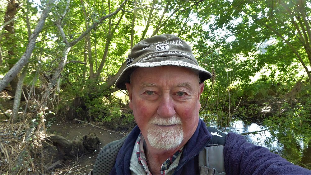
Featured image is the author, Greg at The Pinnacle main Lookout
The Pinnacle is located in south western Belconnen and sits neatly south of the suburbs of Weetangera and Hawker, west of Coulter Drive and is bordered on its south and west by William Hovell Drive, both main arterial roads. The Nature Reserve mainly protects open woodland with the usual stands of Red stringybark, Scribbly gum & Yellow Box. See The Friends of the Pinnacle web site.
Its has numerous management trails and some not so official but very useful trails and footpads.
I drove to Springvale Drive which divides Weetangera from Hawker, and parked near the obvious mobile phone tower and ICON Water Tanks. I think the best spot is slightly further north close to the Gate 5 (G5) and Caveletti 1 on my map.
So at just on 9.46AM I started walking heading down the Valley Trail although stopping to GPS various gates & junctions and side tracks. Soon I reached a deviation that took me west of the main track and after around 250m I reached an east-west track that joins the Valley Track. I took this east to where it joined the Valley Track then followed that south before turning right onto the Limestone Track which took me to a main junction, J1 on my map. Here the Limestone, Dowling Track, Tully Border Track and Pinnacle Central Tracks all join.

Initially I went north up the Central Track checking out junctions and checking a side track that went back close to where I had exited the diversion for the new water main and then to Bunny Hill, 681m. Its not very inspiring and has a lot of scrub on its top although there are views from some rocks.
I continued north up to The Pinnacle checking out more tracks and junctions. I took a rough route down towards the Valley Track. It was open easy walking so it might be part of a future walk. On the way I found a man made shelter, probably built by kids. I then backtracked down to J1 and took the Tully Border Trail right back to the top near Springvale Drive and returned to my car by 12.03PM. The last part along the Border Trail gives some great views to the south and east especially from a Trig Point ST93. It also required crossing the new pipeline route. Looks like its finished down there as you can walk across the work quite easily. They were working hard further up that side track several hundred metres away.
Views from The Pinnacle are superb and can be enjoyed with and easy walk form the car park along Springvale Drive without taking long walks down into the valley below. There is a seat where you can sit and take in the view.
I started at 9.46AM and finished at 12.03AM, having thus walked 6.8Km in 2 hr 17 mins. Ok if you think well that was easy, your right! However I had done an 18.7Km bike ride starting around 7AM and taking 1hr.
Map of walk | Pictures in Google Photos | gps, gpx, GE & jpg map files are all located in Google Drive
Note: The GPS map view was created using Garmin Mapsource on a map base using open source Open Street Maps (OSM) NSW Cycle Garmin map