
17-20 Apr 2018 Main Range Trip – Kosciuszko National Park
This was a 3.5 days and 65Km hardish walk from Dead Horse Gap, near Thredbo to Mts Kosciuszko, Townsend, Twynam, Tate and down to Guthega Power Station on the Snowy River
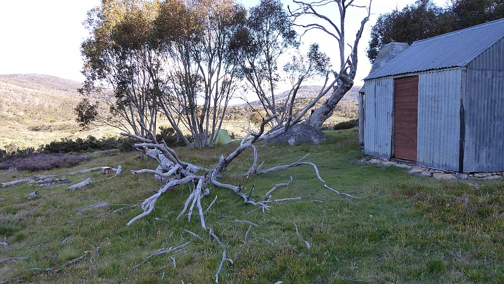
The featured image is a view of writer Greg on Mt Townsend Australias 2nd highest mountain
Kosciuszko National Park – Main Range – Dead Horse Gap to Whites River Hut & Guthega Power Station
Introduction
On the afternoon of the 16th Apr 2018 I set off from Canberra and headed to Jindabyne to stay overnight at my daughter’s house so I could get an early morning lift to Dead Horse Gap and walk the main range track and route to Guthega Power Station. I had planned to start a day earlier but rain, wind and snow on the mountains over the weekend and also Mon 16th delayed me one day. I had planned my walk using some GPS data and tracks from John Evans and especially Karen Cody from her 2010 AAWT walk Dead Horse gap to Whites River section. So My GPS was primed with her track and waypoints for all the key sites I planned to visit or view.
This was a solo trip with all proper precautions taken and following the planned route mostly.
My pictures and maps of this trip are available in Google Photos.
Day 1 – Tue 17th Apr
My daughters partner, drove me up to Dead Horse Gap. There were some large clouds around and some amazing shapes and colours in the very early morning.
Dead Horse Gap Car Park GPS reading 613195 5957302, altitude 1560m approx.
I started the walk at the Dead Horse Gap at about 7.10AM and walked across the road and followed the dirt pad across the river bridge and then down and over a metal bridge across Bogong Creek. In a few metres there is a sign and junction with the right one going down along the Thredbo River and the left one uphill for some 450m before dropping down a little to reach the main Thredbo – Kosciuszko Track.
I was a bit chuffed initially as I could not find my beanie or scarf that I thought I had brought. I was able to find my old balaclava. Later I found the beanie and scarf which helped. It was quite cold. I never found my reading glasses that somehow I had dropped on the driveway at Jindabyne.
Campsites. There is the possibility of camping just south east of Dead Horse Gap as Karen Cody did in 2010 doing the AAWT. Also just before the metal bridge one could camp although it’s very close to the road. On the climb I also found several nice campsites. Campsite4 is probably the best as it is close (150m) from water although it a bit of scramble down to the creek.
On the way up I found several junctions where the track diverged as they were doing some track maintenance and redirection. It’s likely that some of my gps track is not perfectly correct.
After cresting the top around 2000m and passing snow pole lines I was walking through some light snow and thicker snow on the track. As I was dropping down towards the main tourist track I came upon two volunteers I guessed who were placing large stones onto the track. I had already noticed some of this. Later along the main range near Carruthers Peak there are similar stones in place. Hard on the feet if you are carrying a heavy load.
I then put on sun screen lotion and my walking Serfas glasses.
Walking the tourist track to Mt Kosciuszko I was amazed by the number of families and people. I should have known it being the school holidays and the previous 3-4 days had been extremely bad weather. I was also amazed how many people did not wear any hats nor put on sunscreen.
Anyway I had on a beanie with my walking hat pulled tight over it as there was a sharp and bitter easterly breeze.
On the way along the metal track there was a large snow drift across it at the first ridge it climbs over which was giving the other quite a thrill.
At Rawson Pass I could see definitive signs of an old trail going up to the top of Kosc from the pass. It was made clearer by snow lying in its ruts. I wondered if this was the original dray route they had taken to Wragge’s Observatory.
I was on top of Mt Kosci around midday and took a GPS reading. My WP and track show a reading of 2208m which is 20m too low. Not bad as the GPS altitudes are often 25m wrong.
The top was covered with tourists and some young guys were flying a drone from there.
I could identify most of the peaks, Townsend, Twynam etc and even Mt Jagungal.
I then went down the track to the turnoff and picked up my pack which I had gladly left there, and walking along the main trail on increasing snow for 100m and the stopped for lunch. Nice to be able to clean ones knife in snow rather than grass. It was nice and warm in the snow and protected by the bulk of Kosci behind me.
On the way to Mueller’s Pass the track went through a lot of snow and in one place the drift completely covered the track. What in April! It didn’t last for long. I decided to drop my pack at the pass and do a trip out to Mt Townsend and back.
I didn’t know the way as such although I knew people walked around or over the top. So I started from the north end of Mueller Pass and tried to walk around the east side. It was slow going with lots of grass and small gullies to get through. Most of the way around Muellers Peak I saw a defined track a little way below me so I dropped down to it and followed it all the way to Mt Townsend. The top is a minefield with large boulders and rocks. I think the track went around the west side and approached the top from the south which I think might be the safest. The top is quite rocky but has a concrete block like Kosci. The views are supreme with excellent vistas of the main range track to Twynam and beyond as well to Jagungal. You can clearly see how round and unimpressive Mt Kosci is. I took a lot of pictures.
I then returned. There is a fair camp spot juts below Townsend. Also along the track there are quite a few small creeks to cross. Approaching Muellers Pass the track fades but there is a defined cairn some 30m just south of the main range track. There is also good water along the track around 700m along the track which is quite flat over this section.
I recovered my pack and walked down and found a nice flat area to pitch my tent and camp. It had some large rocks that I could put my stove behind so it was protected from the wind coming down from the pass.
The evening was superb with amazing lights and beautiful starry sky. However it was bitterly cold so I retired early around 8pm and read some of my book on a kindle.
I had done 21.4Km today.
Day 2 – Wed 18th Apr
I arose around 6.40AM in a very cold clear morning with no frost and a dry tent.
I then left around 8.30AM and on the way back to the saddle I visited a young man and his 9 year old son who had camped on a small piece of flat land just above the Townsend Track. I then continued along the main track until I could see Albina Lake. I thought I could see rubble so I went down along the alignment of an old track and found the old lake Albina Hut site. It looked like it had been built on very strong concrete foundations. I GPS’d it and took some photos and then followed the track back up to the new main range trail. I followed the old trail eat for some meters and think it must have crossed the main range in a couple of hundred metres then gone down into the creek below (Rawson Ck?) and then taken an old route up to near Seamans Hut.

I rejoined the main track and walked along it passed Mt Northcote. It probably the most exciting part of the trail being a narrow track between a steep mountain on one side and a steep drop down to Albina lake on the other. The views of the lake were impressive and somewhat surreal. I took a picture of what I thought was some rubbish from a tent or balloon. When I got home I realised it looked like a dinghy or inflatable. I sent a copy of the picture to the NPWS at Jindabyne.
I continued onto Northcote Pass and near Mt Lee where I started to meet people doing the tourist round trip on the Main range formal track from Charlotte Pass to Blue Lake to Mt Kosci and back along the Charlotte Pass road. I eventually met a group of trainee soldiers from Bandiana.
As you approach Carruthers Peak you can get a good look at Club Lake down to the east. From the peak there are sign of an older route down towards Blue Lake that must have existed in the past as they have laid grass to try and rehabilitate the old route.
It’s a long drop down to the junction of the main range trail and the formal track back to Charlotte Pass. I continued along the old main range 4WD which winds its way north. I stopped to reconnoitre a route out to Mt Sentinel and check out possible camping in the valley below, which is possible and there is water there as well. Mt Sentinel looks nice but might be scary for those scared on exposed heights. I continued up the trail and stopped to look at Blue Lake down to the east. It’s supposed to be the most beautiful of all the lakes but I thought Albina more impressive.
There is also a section of the area each side of the trail cordoned off as they had found “Mouse-Ear Hawkweed”.

I then stopped for lunch taking a scenic spot on the east side where I could see both Blue Lake and a bit of Headley Tarn.
Then I reached the western side of Mt Twynam, dropped my pack and walked the short distance to the top. Again nice views and was able to send a text message.
Just before Twynam there are some large embankments on the east side of the trail. I suspect these are old Soil Conservation Authority work to protect the catchment of Blue Lake near the top of the range.
From Twynam the trail drops sharply to the west, passes creek, then swings north and climbs a little before swinging east through a small gap and dropping down. Near here there is a possible nice camp spot which is marked by a large cairn. Water is 100m or so the SE.
The cairn might also mark a spot where you can leave the trail and drop down to the east to Pounds Creek flats which would be a nice protected site for camping if the weather was bad.
The old trail then drops downhill sharply for 300m, then swings NW for 300m, then again swings NE while continually dropping down as you pass Mt Anton on its west side.
It then continues in a general north-east route down into a gap between Mt Anton & Anderson plateauing out at around 1875m, before starting to climb again towards Anderson.
As it climbed again I found small plateau and creek and flat land around 1900m and then I camped nearby on some very grassy area around 4PM. I could see down the valley to Pounds Creek but I could not see far to its source due to Mt Anton being in the way.
I thought I was far enough through the gap to be protected from any strong winds.
The trail up from the gap was the start where the old 4WD and the current footpad separated a little, although they both rejoined. Near where I camped it was mostly just a footpad with the 4WD having largely disappeared.
Another early night finished by reading more on my Kindle.
Today I only did 15.7Km.
Day 3 – Thu 19th Apr
I arose early as it was blowing gale and I was worried about getting the tent down. I managed to pack up and was moving about 7.15AM but only walked up along the trail for 200m when it was calm enough to stop and have breakfast.
From here I could see through a gap to Illawong Lodge and up to upper Ponds Ck much better.
I then continued up and past Mt Anderson in very windy weather and kept going through a small valley and into a large open grassy field. Over the filed there was a clear footpad and I continued and found I had lost it. I then doubles back and eventually realised it turned left at a cairn and then was able to follow a whole series of cairns up to near Mann Bluff.
I then followed the path left of a ridge before cresting it at the eastern side of Mt Tate. With very strong winds and clouds sweeping over the gaps I then didn’t go up Tate but continued north along a ridge starting to find it difficult to see where the trail was. The obvious route goes down the eats of the ridge into a small valley where it becomes impossible to follow so I juts tracked through the valley on the next ridgeline and followed it north. However Cody’s gps track that I was following dropped down to the east of the ridgeline and continued north.
I then made a mistake over going over a knoll at the end of the ridgeline whereas Cody’s gps track dropped off to the east. I was wrong and she was right as I had to turn more right to pick up a well-defined track further east down in a large valley. It looked like someone had built a sort of embankment for this track across the valley. It was easy to follow and took me north-east and into Consett-Stephen pass proper and further up a hill and heading onto the ridgeline off to the north. However it soon petered out and resumed following gpx track up and onto – SH 1993 or Peak 1993 as I GPS’d it. It was a large open hill top with lots of small rock peaks so I could never pick the highest. I could not see far as it was in cloud, so I once again followed Cody’s gpx track north along the ridge and then north-east as it dropped off into a large valley where I soon stopped when I found nice shelter for lunch.
I then continued north before veering too far east, then correcting and continuing to walk up and around an exhausting grassy open area before swinging easterly and reaching a well-defined cairn on top of a rock (WP Cn18 on rock) which marks where one leaves this valley swings NNEasterly along the edge of a ridge before joining a wide valley (WP P9) and walking up and crossing the creek in the middle of this valley (WP Campsite10 W). This would make a great campsite in fine weather. I then generally followed up the east side of the valley until cresting a high bend and then noticing that I was joining an indistinct old track (WP T4) which I could follow around the lip of the valley to another crest. (WP T7 near Cn20) From here it was downhill generally drifting around to the right past another cairn (WP CN21) until I found an old 4WD bridge (WP Old Bridge, near WP 11) across a small creek. Across the old bridge where I could see some old tank tracks it was quite scrubby but I could see up a close hillside opposite bounded by a large rocky knoll on each side. It reminded me of being here around 1990 when I had marked those same features near the end of the 4WD that I had then followed. My instincts were correct, but I followed the gpx track slightly more easterly then turned right at a Cairn on a rock (Cn22 on rock) and then tracked in the general direction of the gpx track until I actually reached the real old 4WD track from Whites River. This part was most unpleasant as I slipped and slithered down some steep, slippery and scrubby sections with the last 100m or so being open and easy. I then followed the old track which had now turned to a one person foot track through some patches of scrub down to where it met the trail off the Geehi-Munyang Road into Whites River hut by 3.30PM. However I was quite tired as the trip across the Rolling grounds was exhausting. I knew I had gone the wrong way and decided if I could get up early I would go back up the old track and try and work out the best route.
There was no one at Whites River Hut but I still put up my tent and generally got organised for another cold night. The sky seemed to be clearing and the wind had dropped down here although there still was cold breeze blowing.
I had dinner in the hut using my stove again and didn’t bother trying to put on the pot belly heater they have. I notice White’s River, along with Horse Camp, Mawsons, Boobee, Four Mile all have this Massport Heater. It’s tricky to get going and has to be fed correctly and I have sued them several times but I decline in favour of my down jacket. It was also a lot warmer in the hut then outside.
Whites River Hut GPS 624425 5981909, altitude about 1710m
Today I did 13.6Km.
Day 4 – Fri 20th Apr
I got up early, had breakfast in the hut, then headed out to review the track up from Whites River Hut to the Rolling grounds.
I generally followed a footpad that followed an old 4WD track that had a lot of old tank like tracks embedded into the ground and partially grown over.
I found a side track off down to the creek with an orange pole near its creek end. This seems like a nice route to where there was water and also it offered a couple of camping spots along its short route.
I continued to here I could see an easy way up to a saddle that sat between two small peaks. However I continued to rise along the direction the trail had been following as I could continue to see a faint foot pad as people had obviously walked this way. As I rounded the top of the ridge I lost it as the scrub subsided and the whole vista of a valley opened up in front. I think this the n might be a nice and easy way across to that track I had used yesterday around. My last point (WP 16) was only a little under 500m from yesterday’s track end (WPs T7 & Cairn Cn20).
I then went back in the same direction I had come until I then went back up to the crest of the gap between those two peaks picking up signs of the old 4WD and a footpad on the way. I went right to the saddle and further (WP P12) only some 60 metres above that cairn on a rock yesterday (WP Cn 22). I then returned to Whites River picking up some more cairns (WPs Cn 23-25) I had missed coming up. Clearly these two routes were much better than the one I had taken the day before. On the way down to nearly trode on a White-Lipped snake however before I could snap him he moved off.
I reached the camp by 9.30AM, packed up my tent and gear and was off by 10.05AM to Guthega Power Station. However in the rush I took to shaking water off my tent fly and a little nick I had in it lengthened to 12cm. Bugger! It is a 10 year old MSR Hubba HP 1 man.
I took the Horse Camp Hut Viaduct Trail which is a nicer and higher trail than the main road. Initially I came across the weir and takeon and old SMA nearby hut. Then soon after I came across a Copperhead snake right in the middle sunning itself. It didn’t move so I had to climb the side embankment and go around it.

I continued and since I was high up I turned on my mobile and was able to text my daughter that I would probably be at the PS around 1.15PM. And she got it. But there is no mobile phone reception at the car park at Guthega PS.
At the first intersection I turned left and it took me down to Horse Camp Hut which is a nice camping spot with well-maintained and renovated hut. I think it was completely renovated in 2017.
I then took the road down to the main Munyang Road and walked on this hard and uninspiring Snowy Hydro Road. I should have taken the Viaduct Track that comes out at the same point near the Surge Tank. On the way I had to have a nature break and in process I left my Serfas glasses. Now 2 buggers this day.
I made the car park by 1.30PM and the daughter drove me back to Jindabyne where I changes my clothes, washed and was home in Canberra by 6PM.
Guthega Power Station Car Park GPS 626840 5976198 altitude approx 1,320m
Today I did 9.3Km from Whites River Hut to Guthega Power Station and a further 4.5Km from Whites River up to edge of Rolling grounds and back
Distances
|
Distances per Day |
Distances (km) |
|
1. Dead Horse Gap to Kosciusko & Wilkinsons Creek |
15.6 |
|
Muellers Pass to Townsend return |
5.8 |
|
2. Wilkinsons Creek – Twynam – Anderson |
14.2 |
|
Albina & Sentinel diversions |
1.5 |
|
3. Anderson – Whites River Hut |
13.6 |
|
Whites River to Rolling grounds return |
4.5 |
|
4. Whites River – Guthega Power Station |
9.3 |
|
Total |
64.5 |
Car Distances
The distance was 192Km one way from Belconnen, Canberra via the Monaro Highway, Cooma to the Jindabyne. From Jindabyne to Dead Horse Gap just past Thredbo is another 36Km. It’s about the same 36Km from Guthega Power Station to Jindabyne.
Relevant Topographic Maps
The topographic maps covering the area of this trip are:
1:100,000 older maps: Kosciusko
1:25, 0000 newer maps:
· Perisher Valley for the Main Range
· Geehi Dam for the eastern section around Whites River Hut area
· Chimney Ridge that area near Dead Horse gap
I strongly recommend that keen walkers check out the use of Oziexplorer from Des Newman’s OziExplorer plus OzRaster from GPSOz
Use of Oziexplorer with OzRaster maps for NSW enables you to load up a gpx file and see your route (and one’s available off this trip) on a modern topo map base
Produced Maps, Pictures and Documents
One Google earth kml file, one GPX file and one Garmin gdb file covering the trip with waypoints and daily tracks are in a Google Drive folder.
The above includes one Google earth kml file covering the trip available on Google Drive. Note opening this link will go the Google Drive and open the trip file in Google Earth; you do not have to install Google Earth. You also have the option to download the file or view in Google Maps. Put your mouse over and click on a waypoint and it will bring up a small description.
On the screen captured Oziexplorer maps:
Overview Maps-
“Main Range 17-20 Apr 2018 Overview.jpg” shows the whole trip with WPs on NSW topo mosaic of older maps
“Main Range 17-20 Apr 2018 Overview No WPs” shows the whole trip without WPs on NSW topo mosaic of older maps
Day and Detailed Maps-
Day 1a – “Main Range 17-20 Apr 2018 D1a .jpg” shows Day 1 part a in BLUE track
Day 1b – “Main Range 17-20 Apr 2018 D1b.jpg shows Day 1 part b” in BLUE track
Day 1c – “Main Range 17-20 Apr 2018 D1c.jpg shows Day 1 part c” in BLUE track
Day 2a – ” Main Range 17-20 Apr 2018 D2a” shows Day 2 part a in MAGENTA track
Day 2b – ” Main Range 17-20 Apr 2018 D2b ” shows Day 2 part a in MAGENTA track
Days 3a – “Main Range 17-20 Apr 2018 D3a” shows Day 3 part a in BLACK track
Days 3b – “Main Range 17-20 Apr 2018 D3b D4a” shows Day 3 part a in BLACK track and Day 4 part a in BLUE track
Day 3&4 – “Main Range 17-20 Apr 2018 D3 Whites River to Rolling Grounds detailed” shows Day 3 in BLACK track and Day 4 recce in MAGENTA
Notes: These map extracts came from Oziexplorer using NSW DFSI Spatial Services approval for display of their base map from Topoview 2006
GPS Waypoint Abbreviations Used:
- W = water close by
- Jxx = Junction
- Cn = cairn
- fwo = fair weather only
- Pxx = route point
- Txx = track point, ie old 4WD, footpad
The trip maps showing the trip tracks and various waypoints of important locations are available in the Google Photos album.
My pictures and maps of this trip are available in Google Photos. The original pictures are all ~4000 x 2248, 16:9, 9.0 Megapixels, ~ 4Mbytes. The GPS map extracts are variable but around 800-1000 wide to 660-740 pixels high.
Greg Hutchison, 24 Apr 2018