Arsenic Ridge Track Nov 2019 Kosciuszko National Park Tabletop to Brooks Hut
This information is about how to walk the Arsenic Ridge Track which sits between the Tabletop Trail just east of Tabletop Mountain itself and Brooks Hut down near Happy Jacks Creek. This offers walkers on the Australian Alps Walking Trail (AAWT) the ability to save 2.7 to 6.9Km of distance as well as revisit part of an old historic route from Victoria to the NSW Kiandra Gold Fields, called Ligar’s Route.
The featured image is a view of Temperance Ck where Arsenic Ridge Trail crosses
My pictures of this route are available on Google Photos
Note: on 4/5th Jan 2020 massive bushfires between Batlow & Tumbarumba got out of control and expanded south east to Cabramurra, Selwyn, Kiandra and close to Eucumbene Cove. This burnt Mt Selwyn Ski fields and all the remaining buildings at Kiandra. As a result many huts in Kosciuszko National Park were damaged or completely burnt down. The ones of interest to those on the AAWT or using Arsenic Ridge are: Four Mile Hut (burnt completely), Happy’s Hut (burnt completely), Broken Dam Hut (not burnt), Brooks Hut (burnt), Boobee Hut (not burnt), Mackey’s Hut (not burnt), Wolgal & Pattinson at Kiandra (burnt completely). How does this effect the Arsenic Ridge Track. It is unknown as yet, however the concept is still valid and even more so if Happy’s Hut doesn’t get rebuilt. The plan is to re-approach NPWS in 3-6 months to retape the Arsenic Ridge Track and seek permission to reconstruct a formal track.
In late Nov 2019 five walkers were allowed to survey the old Arsenic Ridge track route from the Tabletop Trail near Tabletop down to Brooks Hut and tape the route.
The result of this survey shows that a track can be readily recut and of length 6.9Km making a nice alternative and shortcut for those walking from Tharwa or Kiandra to Munyang i.e. Guthega Power Station on the Australian Alps Walking Trail (AAWT)
The Arsenic Trail was originally part of Ligar’s historic route that went from Victoria to the NSW Kiandra Gold Fields. Old parish maps show Ligar’s route being represented by a stock route and trail from Doubtful Gap north alongside Diggers Creek before joining Tibeaudo Ck and then across to junction of McKeahnies Ck and Happy Jack’s Creek and then taking Arsenic Ridge up north before entering Temperance Ck valley and continuing up not far from the Tabletop Hut and then to old tracks running north west around Tabletop Mountain.
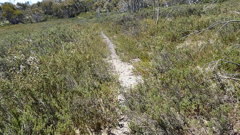
WARNING: This not yet an official trail or track as such. You walk it at you own peril. This doesn’t mean it’s dangerous or difficult. Overall it’s a nice easy-medium walk albeit with some scrub and fallen timber along the route. However it is now fully taped but with biodegradable tape, so in a year’s time or so that tape will probably be gone. However the extensive 211 waypoints will allow anyone to still to walk the route. Note: we used a mixture of pink and orange tape.
Overview
Robert Green spent some time conceiving the concept that some of the old tracks in the Jagungal and other areas were worthy of retaining and many had great historic significance having been used by the original aboriginal inhabitants and of course critical for many of the miners and cattleman who had leases for grazing sheep and cattle in the high country.
Robert has more recently built on those concepts and in early 2019 put a proposal to the NPWS to recut the old Arsenic Ridge route from Brooks Hut to near Tabletop. In this proposal he was supported by David Scott, Graham Scully, Klaus Huenke and Mathew Higgins. They are all members of KHA and well know conservationists, authors and historians in their own right. He was also helped by the recutting of the Hannel’s Spur track and the fact that Arsenic Ridge in not technically in a wilderness zone.
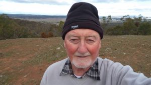
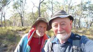
Robert assembled a small team comprising himself, his old long term legal mate Paul Freed from ‘The Shire’, Mika Kontiainen & Stefan De Montis and me, Greg Hutchison. And we surveyed the route over the last 4 days of Nov 2019.
In the first two days 3 of us surveyed from Bolton Hill’s Trail up to the Tabletop Trail. We essentially walked the route 3 times. Along the lower section near Temperance Creek we were able to find old ruts and quite a lot of benched track in some sections, although overgrown in some areas. We also had to try several sections for the best way through with the minimum scrub or trees. We also found two good sources of water.
In the last two days 5 of us walked the Arsenic Ridge section 4 times, twice up and down. We didn’t really find any signs of an old track as the significant regrowth after the 2003 fires obliterated all such signs. We thus created a route close to what some old 1960’s SMA maps showed. At one spot we came across a rocky outcrop and our route goes past this point giving walkers an excellent view out west to Far Bald Mountain and down Happy Jacks Ck as well as down south to Jagungal and out over the happy Jacks Plain.
Another point was difficult to negotiate and that was around another SMA point SMA trig 397 which is the most prominent peak along the route. The proposed track goes over the eastern edge of this peak and one could easily walk higher up its grassy side to get views of the upper Happy Jacks’ plains as well as views over to Tabletop Mountain.
Brooks Hut GPS 637192 5991587
Brooks Hut also has a man-made well around 40m south east down the hill from the hut.

Brook’s Hut Well 55 H 636952 6011639
The water appears OK to drink but use of a filter would allay fears to keep out bits and pieces.
Other relevant points:
Happy’s Hut GPS 55H 638725 6013661
Tabletop Hut ruin 55 H 636415 6017322
Altitudes and Access to the Track
The altitude at the north end of the trail on the Tabletop Trail is around 1,700m and its 200m south-east of the old SMA Emergency landing strip (ELG) now signified by an old tyre on a fence or tree branch.
The altitude at the southern end at Brook’s Hut is around 1,500m. Brooks was rebuilt after the 2003 fires.
To get to Brooks one must turn down the Happy Jacks Road at its junction with the Greymare Trail, and then after 750m turn right down an unmarked grass trail to the bridge over Happy Jack’s Ck ie 550m, then continue for another 1.7Km to Brooks. Thus it’s 3Km from the Greymare Trail to Brooks.
To get to the top of the trail just go along the Tabletop Trail from Kiandra, go past Tabletop Mountain and on the right you should see the top of the ELG signified by an old tyre on a tree branch or post on the right. The cairn that indicates the start of the trail is exactly 200m further along the track and on the right about 20m on top of a large stone platform.
Water Availability
Brooks Hut. There are several options for water:
- The Well, 40 m south east of Brooks hut
- Happy Jacks Ck. It’s around 1.7km along the track to this creek which is permanent water. The next water heading south is Barney’s Ck on the Greymare Trail.
- Water might also been obtainable from a creek directly north of Brooks about 300m at
GPS 55 H 636896 6011921. Probably not in dry periods.
Tabletop Trail. You might think that there is no water around.
- However it should be available down the hill around 300m from the ELG at H 636321 6017109 which is an embankment that collects water to feed into a race to 9Mile Diggings. It’s not clear there is water after a dry summer.
- There is also water and possible camping at 55 H 636836 6017785 which is 300m north along the trail from the tyre and then 300m downhill to the north east. Here you will find a large race with a creek a few metres below it. It had a some water which had to be scooped out in 30April 2019 .There are grassy areas with lots of dead trees back up the hill a short distance (I camped around here in April 2019)
- The next water along the Tabletop Trail going north (except during snowmelt when some water flows down across the trail) is at either 9Mile Ck or Broken Dam Ck on the 4Mile side Trail next to the Broken Dam Hut. Further along Tabletop Trail there are two tributaries of 4Mile Creek that cross under the trail and then the next water is not until Pollocks Gully near Kiandra.
Between Tabletop and where Tabletop intersects with Happy’s Hut track and the Tolbar Rd there is no water. One option is to walk down the Boltons Hill Trail for 1.2Km and then north for 200m down to Temperance Ck tributary. That’s a large detour. Water is usually available along the muddy Greymare Trail before Happy Jacks Rd and after that at Barney’s Ck, and of course by a 2.1Km side trip to Happy’s Hut.
The Arsenic Ridge route solves the water issue by having water at two Temperance Ck crossings, one being a tributary. Both are usually running.
Camping Possibilities
There is possible camping not far from the top of the trail around 500m north of the top Cairn and then 150m north east off the trail near GPS 55 H 636705 6017694 i.e. not far from water and not far off the Tabletop Trail and also close to the top end of the Arsenic Ridge Route.
Half way down it would be possible to camp just north west of the Bolton’s Hill Trail around 55 H 637178 6014840, its 200m from the Temperance Ck tributary.
Another possible campsite could be 55 H 636948 6015665 where it’s flat and grassy; its 330m from the main Temperance Ck and next to point TB046.
Along the Arsenic Ridge section proper the only feasible campsite is in the Grassy Saddle just north of SMA397 ie GPS 55 H 636736 6013463 or Waypoint TB119. However there is no water here. You would have to go down the hill from the saddle a fair way, probably best towards the Temperance Ck side.
And of course at the bottom there is Brook’s Hut where you could sleep 2 in the hut or camp outside. There is an open fireplace in the hut.
Points of Interest on Arsenic Ridge Walk or Nearby
From top to bottom here are some points of interest:
- Tabletop Mountain – it can be climbed from a point along the Tabletop track or from the south eastern end quite easily
- At the south eastern end there is also the top of the old SMA emergency airstrip (ELG). It used to go downhill to the south west. It’s still all there and is not overgrown with trees or scrub. The top of the ELG is at the track identified now by a tyre on a tree branch or post.
- Also down in a south western direction around 150m and on the north-western edge are the ruins of the Tabletop Hut. One can still see the stones from the fireplace with some pieces of corrugated iron lying around (there are no collectable items like bottles)
- Tabletop water race to Nine Mile Diggings. On both sides of Tabletop there are large water races that collected water from swamps and creeks and took water to the header dam at the top of the main sluice gully at 9Mile diggings. The header dam is easily seen just to the east of the main gully which anyone passing should have seen. The races on both sides come together as the Northern race turns and goes through the Tabletop Track just north of Tabletop in a low point saddle. Obviously the track has now filled in that part of the race, however the race is visible on both sides of the track. The start points of both races are shown on the Arsenic Ridge Track maps. The races are not that easy to follow due to scrub and terrain issues. However the southern race started some 700m east of the Arsenic Ridge route and crosses it at TB16 waypoint. The race continues around to the north passing a point with a 4 foot drop and then reaching the embankment below the ELG after which it continues in a large well build structure. It’s now quite scrubby along some of its journey.
- The North Race starts around 500m North East of the start of Arsenic Route. The race then runs north for nearly 400m before entering scrubby country. Over this distance it is in open grassy country and easy to follow.
- South of Bolton’s Hill Trail about 400-500m and 130m south-east of the taped route there is a Cairn on a Rocky Peak and 100m north of the cairn there are several redish Rocks lying around in grassland. These are quite red in part and not seen in other rocks around.
- Peak with Views (SMA397). This peak is slightly off the route however it can be easily reached from the route that passes near its eastern edge. It’s an easy walk to the top from around waypoint TB130. There are views north across to Tabletop and views east over the Northern end of Happy Jacks Plains.
- The Rock (TB167). This site is a gem and offers great views of Happy Jacks Creek valley and gorge, south west to the big peak which is Far Bald Mountain and south south west to Jagungal. From lower rocks you can see down to Brooks Hut and over the plains beyond it. It’s not actually one rock but as series of flat rock platforms that you can easily walk between.
- Brooks Hut’s Well. This is a small concrete based square hole around 30-40 south west of Brook’s hut. I don’t know the history but it seems to have been there for a long time. There are few huts in the mountains with an active well.
Walking the Track (or Route)
Starting from the top at a small cairn (point TB001) just off the Tabletop Trail one walks south then a south western direction for around 450m over mostly open grassland, with some trees around, to point TB011. After this point the trail will start to drop more steeply in a southerly direction again with more scrub to negotiate as well as crossing the old Tabletop race until in around 250m point TB018 is reached whereupon a large open field will be seen. This is the place nicknamed the Swamp even though it has mostly a solid base of rock underneath.
The old route seemed to cross this area just south of a Large White Stone (TB019) so one needs to track east for 30m before turning south to cross the swampy ground which from its middle becomes more solid ground until after around another 250m some trees will be reached at point TB021. From here the route will join a ridgeline that tracks down to Temperance Creek. Initially it runs south east (SE) for around 100m to point TB025 through open country in a wooded area. Then the track turns more SSE for 200m to point TB032 and then SE again for 260m reaching Temperance Creek at point TB038.
This is a good spot to take a break with some rocks on its western side that can be sat on and for any water needs to be satisfied as it’s the best reliable water around.
The creek can normally be stepped across and then a slight right turn taken to climb up an old vague cutting to then continue slightly uphill in a more south easterly (SE) direction for just over 200m to point TB044 where one needs to turn slightly to take a southerly direction through gaps in the scrub for 50m or so before reaching a large open grassy area that one can walk down in a SE direction again for just over 200m to around point TB051, and then swing slightly left or east for 50m, and then from point TB052 one should follow an obvious old rut in a SSE direction for 540m to point TB064 which is a tributary creek of Temperance Creek and the last water before Brooks Hut. It would also be possible to camp around here, or a further 100m or more south in some trees near the Boltons Hill Trail.
From this creek the route is across some soft ground in a SSE direction and then finishing in a south direction for 225m to reach the Boltons Hill Trail.
This finishes the Temperance Creek part of the route. The section to the south is the real Arsenic Ridge portion.
From Boltons Hill trail there is a clear opening across the track to the south east which if taken you will in just under 100m come across two old gate posts which is the sign you’re going in the right direction. From these posts (point TB071) the route swings SW for round 130m before at point TB073 swinging South for 200m to point TB075. This is all open grassy ground.
From here the route starts out SW through some scrub and swings around over 350m to be in a southerly direction at point TB086. From here the route tracks SSW for nearly 100m to point TB090, from where it then goes roughly South for 120m to point TB095, after which it swings SW for about 200m to point TB109. Then it’s largely SW for 260m down to point TB119 which is the middle of a Grassy Saddle.
From this saddle the trail continues largely SW for 170m to point TB125 where it starts to swing more southerly. From near here it would be possible to climb up to Peak SMA397 which offers views of Tabletop and out over some of Happy Jacks plain.

Its then largely South for 430m until point TB145 after which it swings more easterly and then back to southerly over around 200m to point TB152. The overall going is largely easy and reasonably open country.
It’s then largely easy walking for the next 160m to point TB160. It’s then largely south again over 150m with some zig-zagging down to TB167 ‘The Rock’ where there are great views.
After the Rock the scrub intensifies and the track takes a SE direction for 50m before it turns SSE at point TB170 for 120m until at point TB174 it turns SE for 50m until at point TB175 after 75m it turns SSE again until at point TB179. It then runs in a SSW direction for 350m until at point TB193 it turns to a SE overall direction for 300m to point TB204. Its then goes in an East direction for 100m to point TB208, after which it drops sharply in a South East direction for 125m to Brooks Hut at TB211.
Is Arsenic Ridge Route Shorter than Tabletop Trail – Tolbar Rd – Greymare Trail?
The Arsenic Ridge walk will be 6.9Km plus Brooks trail to Happy Jacks Rd junction plus a small part of Happy Jacks Rd is another 3.1 or a total of 10.0Km
Walking north from Greymare Happy Jack’s Rd junction then on part of the Tolbar Rd and the Tabletop Trail is 12.7Km. So overall the Arsenic Ridge walk can save 2.7Km of boring road walk.
However many AAWT walkers go to Happy’s Hut and either walk back to the Tabletop Trail or bush bash up the hill to the north to rejoin the AAWT near the Tabletop and Bolton’s Hill Tracks junction.
The trip from Tabletop Track to Happy’s is 2.1Km each way so if a walker went to Happy’s and came back the same way which probably most do, the Arsenic Ridge option could say them this extra 4.2Km thus making a total saving of 6.9Km.
Relevant Topographic Maps
The NSW topographic maps covering the area of this trip are:
1:50,000 older maps:-
Eucumbene, if you can get it, for section Brooks to Bolton Hill Trail, and the
1:25,000 newer maps:-
Denison for section Bolton Hill Trail to Tabletop Trail
Old Adaminaby for section Brooks to Bolton Hill Trail
I used Oziexplorer Mapmerge with the following 1:25000 maps Denison, Old Adaminaby, Cabramurra, Toolong Range to create a suitable map to show Arsenic Ridge and its surrounds. However the whole area of this track from Tabletop Trail to Brooks is covered by just 1:25000 maps Denison and Old Adaminaby.
I strongly recommend that keen walkers check out the use of Oziexplorer from Des Newman’s OziExplorer plus OzRaster from GPSOz
Use of Oziexplorer with OzRaster maps for NSW enables you to load up a gpx file and see your route (and one’s available off this trip) on a modern topo map base.
Of course there are new options with topographic maps that can be used on mobile phones.
GPS Waypoint Numbering
All relevant waypoints are numbered from the top to bottom ie north to south starting at TB001 Cairn adjacent to Tabletop Trail and finishing at TB211 Brook’s Hut. The simplified maps only show some waypoints yet the main gpx file has 211. TBxxx means Tabletop Trail to Brook’s Hut. This public version of map has more Waypoints shown on the map then the original simplified version but the gpx files included all 211 waypoints.
There are two sets of waypoints in two separate GPX Files. The first contains all 211 track waypoints plus all the other items of interest, thus 244 waypoints all up. The second contains a modified reduced set of 66 track waypoints plus all the other items of interest thus 99 waypoints all up so that those who can only handle less waypoints can use it. However you may be better including all the waypoints on your GPS until the track is approved and cut.
Produced Maps, Pictures and Documents
On the screen captured Oziexplorer maps: – Oziezplorer Maps using NSW Ozraster Base Maps:-
Overview Maps for showing Arsenic Ridge Route versus Tabletop Trail
- “Overview Arsenic Track Area Tabletop to Brooks Hut – NSW Topo.jpg” – overview including Tabletop Track, Happy’s Hut Track
- “Overview Arsenic Track Area Tabletop to Greymare Happy Jacks Rd Jn – NSW Topo Mosaic.jpg” – wider overview including Happy Jacks Road
- “Overview ArsenicTrack Tabletop to Brooks Hut – Reduced Waypoints – NSW Topo.jpg” – shows Track with minimum Waypoints
Detailed Maps North & South Maps
- “ArsenicTrack Tabletop to Brooks Hut North Section – NSW Topo.jpg”
- “ArsenicTrack Tabletop to Brooks Hut South Section – NSW Topo.jpg”
Detailed Maps 3 Sections – North, Middle, South
These are slightly more detailed than just two maps and maybe more useful. These are recommended for anyone walking the route for the first time:-
- “ArsenicTrack Tabletop to Brooks Hut North Third Section 1 – NSW Topo.jpg”
- “ArsenicTrack Tabletop to Brooks Hut Centre Third Section 2 – NSW Topo.jpg”
- “ArsenicTrack Tabletop to Brooks Hut South Third Section 3 – NSW Topo.jpg”
Notes: Map view extracts came from Oziexplorer using Oztopo Ozraster maps for NSW © BKK Enterprises Pty Ltd, http://www.gpsoz.com.au with the source date from Spatial Services, DFSI NSW. GPS files available on Google Drive. Map view extracts also came from using Garmin Mapsource using Oztopo base maps with permission of © BKK Enterprises Pty Ltd, http://www.gpsoz.com.au
Maps showing the tracks and waypoints of important locations are available in a folder in a Google Drive folder and the Maps are also in the Google Photos album which also has some photos showing some bits of the route and items of interest.
GPS Files
Two gpx files covering the track with waypoints are in a Google Drive folder. These files are:-
- “KNP Nov 2019 Tabletop to Brooks – Arsenic Ridge – All Track Waypoints with other useful Points.gpx” – whole route 211 track points
- “KNP Nov 2019 Tabletop to Brooks – Arsenic Ridge – Modified Reduced Waypoints with other useful Points.gpx” – whole route 66 tracks points
Greg Hutchison, 20 Dec 2019
WordPress tags –