2023 08 03 Mt Tennent Walking Track, Namadgi
This was a one day walk from Namadgi Park HQ near Tharwa up a part newish walking track to the top of Mt Tennent and back
The featured image is a view of Deadmans Hill and Booroomba Rocks west of Mt Tennent
My pictures of this trip are available on Google Photos.
Points of Interest
This is a tough walk to the top, an altitude of 1394m from the car park at the Namadgi National Park HQ which itself is at an altitude of around 645m making the trip climb of around 750m.
On 3rd August 2023 I took a trip to Mt Tennent return using the new and updated walking track to Mt Tennent. I returned slightly differently to the outward journey by returning down the management dirt road that was used by the earlier walking route.
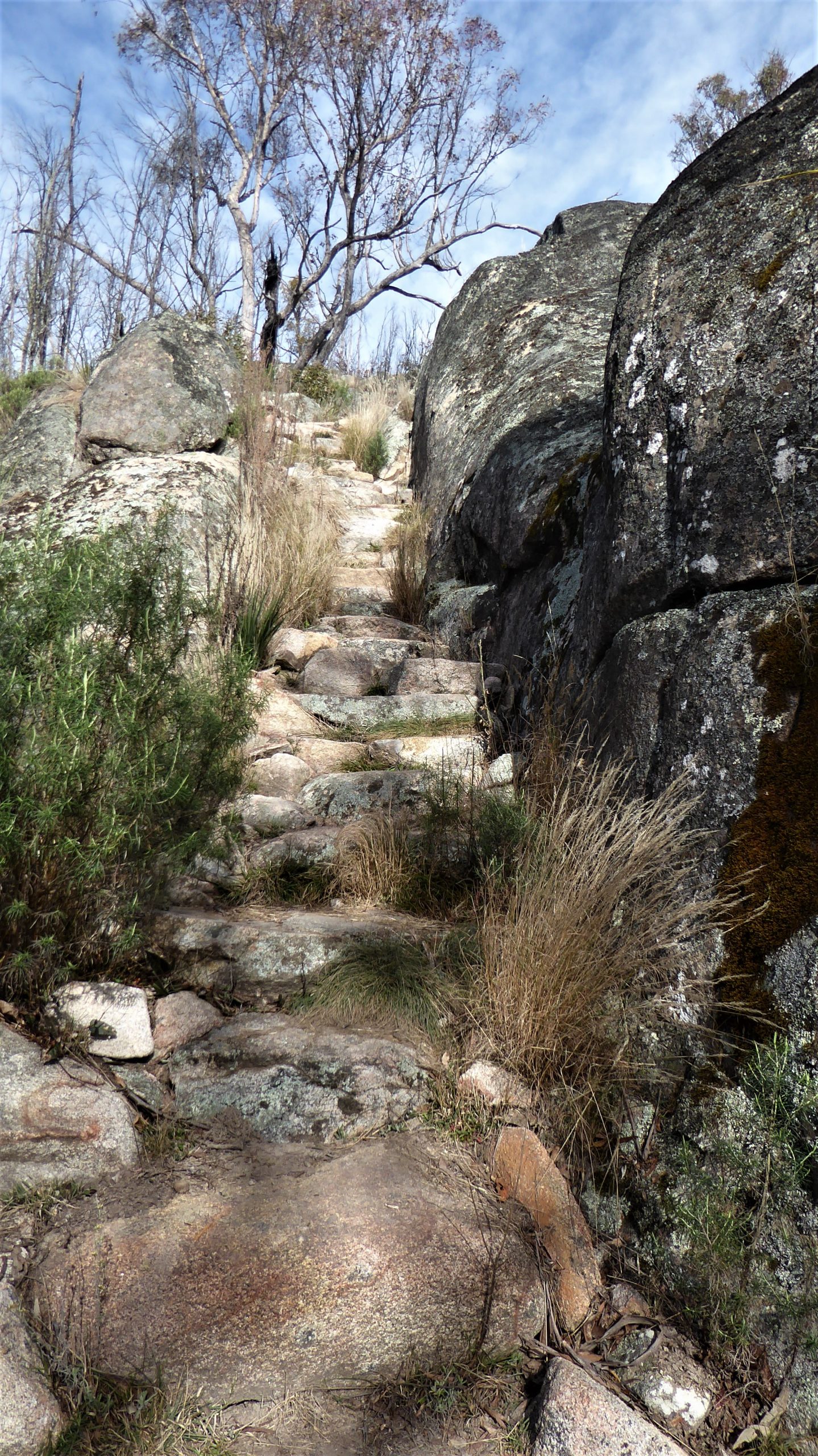
The new track section provides a more exciting route to the top with several nice rock platforms providing views to the east and some of the north. It has several rock step sections and is quite narrow in places. It will require more regular maintenance as some of the bush has started to grow thickly.
In a couple of areas the foot track and road are close by. In fact if you return down the road you might like to walk through a few metres of bush to rejoin the new track and thus save some distance off the overall journey.
I was delayed a little as there was a traffic accident on road from Canberra at the Condor Petrol Station. I had to deviate east through Condor to regain the main road further south.
I left my car at the front gate at the entrance to the Park HQ at 8.55AM and headed through the reserve behind the centre to cross the main road and start the climb to Mt Tennent.
The first section to Cypress Pine Lookout is fairly simple and relatively easy. Just before the lookout there is an area of rocky open slabs with a creek running through it also providing some nice views. Cypress Pine Lookout is then reached with a seat that many use.
After this spot the trail passes over two metal bridges then becomes steeper and more winding.
I then reached a junction where the new waking track starts and took me along the edge of the eastern escarpment. In several sections there are some rock steeps cut in the rocks as well as providing some rock platforms that gave views to the north and east and of Castle Hill to the north, Mt Rob Roy to the north east and Gigerline Reserve to the east.
The old firetrail to the top can also be seen to the right as I continued climbing.
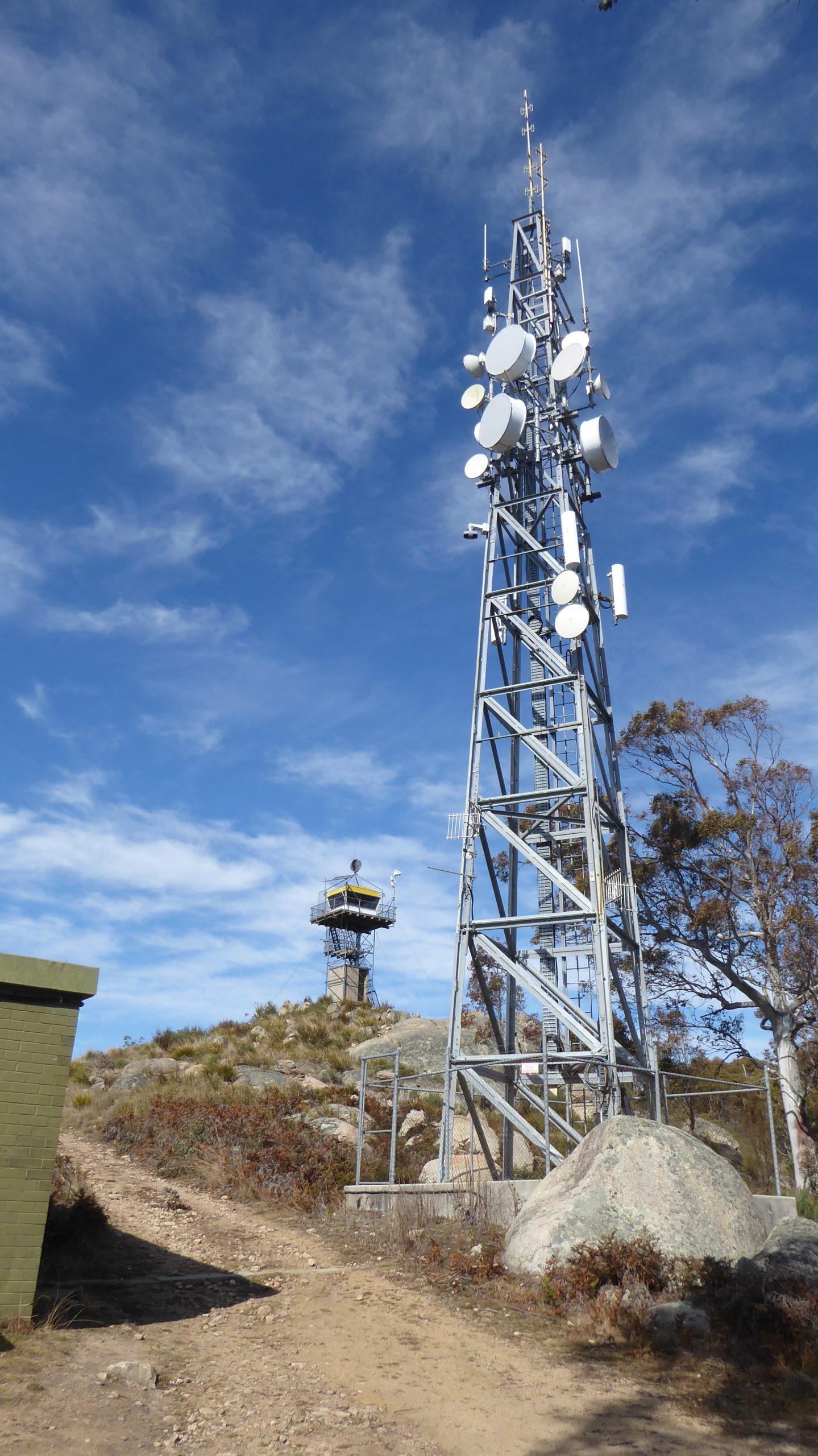
I did continue and eventually reached the top coming up from the south side of the peak around 11.55AM. It was blowing quite briskly from the west so I went around the fire tower and had a quick lunch but on its east side, getting good views even down to the south east where the Tinderry Range is.
Also from Mt Tennent I got a good view of peaks out to the west. Also to the south west there was great views of Deadman’s Hill and Booroomba Rocks.
I then headed down the road which I found a lot easier, although walking up it, years ago it has been hard. Part way down I was passed by a lady jogging up the road. She later passed me going down. She was apparently running from Apollo Road return. Ouch! Impressive. I continued until I could turn right to pick up the old trail that would take me down to rejoin the Mt Tennent Walking Track in 1.3Km.
I then took this old link trail but came upon an Asian group led by an Outward-Bound female guide who was taking them down to have lunch near where I had rejoined the track. I also reached the junction where the AAWT branches off the trail. Its only 100m west of the Mt Tennent new track turnoff.
I went back down the original part of the Mt Tennent track meeting two more individual men. The first was totally unequipped carrying no water. The second was near the bottom. He was my age and knew a lot about the mountains having walked the Stockyards Spur trail, knew John Evans and was also cognisant about the pronunciation of Boboyan. He was walking only to check out butterflies near the Cypress Pines Lookout.
I reached the HQ and car about 3.10PM, thus having done the 14.3Km in around 6hrs 20m. This was a bit slower than John Evans last year although my route is 1Km longer.
Link to GPX file and two versions of Maps of the walk on Google Drive. These are jpg files – Google Drive files
Link to Photo Album
A few thoughts
A lot of the Mt Tennant track is easy open walking. However above Cypress Pine its quite rocky, winding in place with many rocks protruding from the ground. I noticed I had many small trips caused by loose rocks on my boots. Its really not the sort of walk that you can race or run. If want to do that take the alternative route from Apollo Road which is graded dirt road.
My legs were tired after this walk. I also had experienced pain in my knees coming down the section above Cypress Pines Lookout. Luckily its not as bad as the Stockyard Spur Trail. Take it easy and be careful. You need to carry water.
Greg Hutchison, 5 Aug 2023