2022 06 14 Mt Ainslie Northside Tracks
This was a 7.6Km recce walk around the northern side of Mt Ainslie Nature Reserve in Canberra Australia. It was relatively easy although with issues on access and safety.
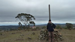
Featured image – View of Track from near Hancocks Rd Saddle around to CCT
This walk was a follow up on a previous walks to check out some tracks on the northern side of Mt Ainslie.
Access was via Antill St, Dickson, then around the big roundabout & up along Phillip St (watch school zone) to turn left into Kellaway St and park at the nice car park on the right.
I started by walking south along a nice footpad that took me to the bottom of the Mt Ainslie Old Tip Track and its junction with the 132KVA West Powerline Trail. There was a large gum tree down across the track so I had to detour around it which worked ok. I then went north east for around 225m to turn right and travel east up a foot trail for 400m. I then started checking out some new tracks I had noticed on Open Street Maps (OSM). Firstly I went south up a trail that would have taken me up to join that Old Tip Trail but in 50m I noticed another trail taking off to the east and I followed it for 140m. I then came to a junction that was not very well used but I took another track south east which I went up for 350m to reach the summit of a knoll that I decided to give the name Little Mt Ainslie. I had been here before but from the Mt Ainslie side and on that occasion I could not find any track going down to where I had come from.
The significance of this track was that it now provided a high level link from Mt Ainslie through to Mt Majura although there were several ups and downs along that route, overall this is still better than than other options. Also the route via Little Mt Ainslie is nicer on the feet being largely a grassy little trail and not too steep.
I went back down the way I had come and went across to the gap at the top of Hancocks Rd looking for the best link. Then I tried to find the continuation of the first trail I had found that was supposed to go south and not too far off the East 132KVA main trail and eventually join the Lower Beacon Track. While I did not find this trail as such, I did walk just under 2Km looking for signs of the old track. I did find some signs but most of the area was overgrown with grass. I found however, a walkable track that went from the bottom of that track up to Little Mt Ainslie around the side of the hill and eventually joined the Canberra Centennial Trail (CT) trail that goes from the 132KVA East Trail up to the 5 Ways Junction. I also found it possible to walk from the bottom of the ascent trail across to the gap where Hancocks Road goes without much difficulty.
After, I walked down to the spot I had been originally, and went up this other track to the Old Tip Track and then descended but stopped at the ‘5 Senses Labyrinth’ just to ensure it was still there, which it was, and also looking in good shape. I then went down the Old Tip Track and then on the first trail I had come on and back to the car.
This was an Easy Medium exploratory walk of 7.6Km, taking about 3 hrs.
Map of my walk walk | Pictures in Google Photos | files including gps located in Google Drive
Photos and Google Drive links show maps of my actual walk plus OSM base map
Notes re Map: GPS Map View provided using Garmin Mapsource on an OSM base | The area of the walk is covered by the NSW 1:25,000 topo map CANBERRA