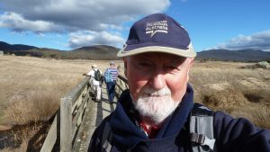
2022 05 03 Toolong Diggings & Wheelers Hut (Kiandra 21)
This was a 3 day and 36Km walking trip to and around Toolong Diggings, as well as walking the Snakey Plain & part of the Dargals Trails. This was all within Kosciuszko NP south of Kiandra. This was a continuation of many similar trips since 2011.
The featured image is a picture of the Tooma River upstream from the Wheelers Hut Track Crossing
More pictures on Google Photos
1 – 3 May 2022 – Toolong Diggings, Wheelers Hut, Tooma Dam & Snakey Plain Trail (Kiandra Trip 21)
Purposes
This was a 3 day walking trip to and around 9Mile Diggings, then back and down to Four Mile Creek Diggings and finally Giandarra and 12 Mile Diggings. The weather prediction for later in the week looked ominous and it turned out to be accurate. I walked 36Km over the trip.
This was all within Kosciuszko National Park just south of Kiandra along the Snowy Mountains Highway. This was a continuation of many similar trips to other Kiandra diggings sites. I had visited Toolong Diggings in March 2010 with others including Robert Green, David Beasley, Phillip Crampton and Graham Scully. I ended up documenting as much as possible on that journey and sending it to David Scott. On that trip we had visited the opening of Pretty Plain and had information from John Williams and the HAS for Wheelers Hut that guided us on some sites to look for although we did find a lot of pits or shafts on the area David has called Toolong Reef Diggings.
On this trip I had the old data we had send to DS plus I had a full list of sites from his database plus I also had some of his topo maps for the area, although they had extra sites around Toolong Diggings that were not in the gpx database. This created a lot of confusion for me.
The aim was to check on several issues with the data and to search for a cutting or diversion near the Tooma River crossing as well as walk the Snakey Plain Trail. I ended up achieving very little in the way of finding new sites or verifying previously found sites
I also planned to stop at 3Mile Dam and even spend one night there to check out an area on the Link Road where DS thought a special flume had crossed that area from 3 Mile Dam Ck and sent water to Bulls Head Ck? I also planned to look for GT Dam 7 (from an earlier study around Kiandra) which is supposed to be on the east side of the Link Rd. I also had an itch to walk from 3Mile on the Gold Seekers Trails and cut across to an area just west of Selwyn to try and pick up a race from Larry’s Ck that I think went to 3Mile Ck’s source.
I ended up achieving none of these latter items. It was too dark when I came past them late on 3rd May. I was also disappointed in the trip as I did not find many new items. All the huts sites were extremely uninspiring and I think most were more like tent sites, except the Old Toolong site.
Points of Interest

I reached Tooma Dam area ok on a Sunday. After parking along the Tooma Rd near another vehicle I was surprised to see 3 people coming back to the other vehicle. I asked them what they were doing and it turned out they were a small team working on a thesis at Deakin University. Part of their project was to take samples in KNP of the density of broad tooth rats in a number of areas. This would enable them to determine the number so rats in an area and the health of the population. They told me the area they just came out of seemed to have a good population of these rats. They were staying in Adaminaby at some nice old place. They also went up Jagumba FT to check out another sample site. I had to teach them how to pronounce Kiandra and even Tatangara.
Snakey Plain FT started out as OK but eventually it turned nasty as it climbed very steeply up onto the Dargals Range. I thought later the track should be renamed Sneaky Hills Trail.
David had a couple of huts in his DB that are just west of the Tooma Rd, Montagues Hut c1961-86 (55 H 612560 6009680) and Pierces Hut c1915-75 (55 H 612550 6009670). From where I parked they may have been 270m bearing 310 deg. Just across the road from where I parked was a rough turn off for the Jagumba FT which crossed a small creek before it headed up a hill into the bush. I noted that there was a small open area that went south west up into the bush in the direction of those two huts. Thus it might be possible to search for them in the future. Most of the bush around is quite thick and dense however. I noted from one of those old maps of Snow Leases and Permissive Occupancies in 1952, at the top of this map near H14 it shows a Pearces Hut which is nearly directly north of Wheelers Hut on the same map. There is also a Pierces Ck in the area! So maybe they did exist!
Climbing up the Wheelers Hut Trail from the Tooma River is also fairly steep and intensive although it flattens out fairly soon and then its more reasonable.
Toolong Hut or Outstation is no longer marked as you walk along the Dargals Trail but you can identify the area by the change in vegetation.
I also noted a new 4WD track heading off west from the Dargal FT towards Toolong Ck, 1.1Km south of the Toolong Hut site.
The extent of the Jan 2020 fires along the Tooma Rd seemed to be around Ogilvies Ck area. The area north of that point was decimated whereas south retained the earlier tree cover and heavy vegetation. There is work being done on the road down and over Tumut Pond with roads at the higher sides in good condition but a bit potholed and damaged down near the Pond. The Link Road is in good condition and they have improved and tidied up the old bush entry down to 8Mile Diggings. I don’t know if they have cleaned up the trail below. The entry to Lobs Hole has been significantly altered with lots of storage area, flashing lights and very strong lights covering the area at night. It reminded me at night of a scene from The X Files.
Truck traffic on the Link Rd north and Snowy Mountains Highway is still heavy.
Access to Mt Selwyn is blocked along Kings X Road and it’s also closed at the Cabramurra end. I think the old cafeteria building and public access facilities at Cabramurra are gone and thus there is no real public access there. 3 Mile dam is open and the public can camp there.
I noted that there is no barrier at Pollocks Gully Kiandra and no reason one could not drive up to the Pattinsons Lodge level, but no higher.
I was so late on my last day I could not check out any of these further.
Maps Data
I took my planned data to check out from my first trip in March 2010 and David Scott’s data he sent me in late 2021 which was in three files:
- gpx – This is a full list of all David’s Database but not roads or old tracks, just waypoints of historic sites i.e., huts, dams, mines, yards, etc
- Toolong Diggings.pdf – This is an extract of his derived topo GIS maps showing document
Chapter XX: Big Bogong to the Dargals 1852-1958 – DRAFT D Scott 6 Jan 2020 a map section covering Toolong Diggings with derived topo GIS map showing various sites around the main Diggings. It includes some extra sites not in the gpx file! - Toolong Plains diggings.pdf – This is an extract of his Chapter XX: Big Bogong to the Dargals 1852-1958 – DRAFT D Scott 6 Jan 2020 with only the map covering 4.2 Toolong Plain Diggings & Tooma River Diggings at Reservoir 1860 & 1895 with derived topo GIS map showing various sites around the Reservoir and Toolong Plain. It includes some extra sites not in the gpx file!
These last two pdf documents include sites that were not in the Database gpx file. I have made a list of these sites none of which I could find. The list of sites is in a Word copy of this post.
I made an educated guess from the pdf map and placed these sites into my Garmin GPS map, which might explain my difficulty in finding any such sites. Many were in areas of heavy scrub which made access quite tricky or impossible.
Access to the Toolong Plain and near the reservoir was unclear to me so I did not even plan to try. I did notice a new 4WD track heading south from the Dargals FT that might provide access to the plain.
1st May- Day 1 – Snakey Plain Trail
I did leave Canberra a little later than expected i.e., 7.05AM on Sun 1st May and reached Snakey Plain Trail after 12.00PM.
On the way I stopped at Cooma for fuel and brekkie snack at Maccas. I deviated into Kings Cross Rd to check out the barrier into Mt Selwyn. I also went to 3Mile Dam Camp area and spoke to some guys.
I decided to park near Snakey Plain trail entry but parked some 750m north and nearly opposite the Jagumba Ck Trail junction. I headed out from here around 12.35PM. Might have been 1.30PM.
There was minimal space at the Snakey Plain trail gate, although there was room for 2-3 cars opposite the gate but around 50m north. What I did not like about this spot were the very tall trees over its top.
It was easy going to Wolseley Gap but I did not see DS’s Snow Poles nor his Wolseley Gap Hut site. I wasn’t looking where DS has the site as my trail gps was quite different to the Oztopo trail I could see on my GPS. Maybe they have moved the trail over time.
The trail then climbed steeply (yes very steeply!) from 1340m to 1580m without any real break. Phew. It just went up and up and up. Then it went down until crossing Snakey Plain Ck it dropped down to 1430m before climbing again to nearly 1500m before dropping to 1326m as it joined the Wheelers Hut FT. The final leg to Wheelers hut was downhill a little crossing a tributary of Dargals Ck before reaching Wheelers Hut around 1325m at 4.08 PM. Wheelers Hut 55 H 612764 6002684. My old reading.
I was then quite tired so I set up my tent, collected water and some wood. The thing I remembered about the site was the continuous stream of planes travelling down from Sydney to Melbourne. Looking south east across the valley and through a gap in the hills I could also seek Mt Jagungal.

Going around the back of the hut later I disturbed a possum and I remember hearing some noise from the hut at night. I guess some possums may have perched themselves on the hut somewhere.
This 1st Day I had walked 10.3Km. Note the distance from the Gate on the Tooma Rd to Wheelers Hut on the Snakey Plain Trail was 9.2Km ignoring some deviations to check things and the distance from my parking spot to the start of the trail.
16th Mar- Day 2 – 9Mile
I got up around 7AM with everything frozen. But a nice sunny day picked me up and I headed off with a simple day pack to search around the higher ends of Dargal East and West Creeks.
I didn’t get to some items south of the hut, Apple Tree, Shaft, ?19 Diggs, ?20 shaft the last two from David’s PDF file.
I started by heading for the Kero tin and Fireplace that were obvious sites south east of the Hut. The valley south was heavily overgrown over most of it as was the area around the Kero tin and Fireplace. I could see nothing. Just goddamn thick scrub.
However nearby I found a fenceline still intact and followed that to the site of Old Toolong Harveys-Wheelers Hut DS c(1895-1933) DS 55 H 612933 6002439 DS It had Jean Rice in the reading. My reading was 55 H 612934 6002440. I took several pictures as there were some rock and metal items lying around.
Down hill from there I looked for a couple of DS new sites ?27, 55 H 612863 6002410 and ?28, 55 H 612885 6002387. The GPS was my guess from the map. I could see neither. It was open here with good visibility.
I then headed south east down over broken ground and over Dargals Ck West. Initially I came across a side channel to the creek maybe 40m long. It had been built as you can see stones piled on the east side of the channel in a man-made fashion. At the southern end of the channel it opens out into a normal creek and bank setting whereas north of the said channel the creek exhibited a very high bank on the eastern edge of the creek. I went to the creek bank then headed SSEast up on the area between the two Dargal Cks. Very quickly I came upon a strange very thin race like structure with a pit next to it. New points Possible race GH 55 H 612914 6002218. Pit22-1 GH 55 H 612916 6002216. I then came upon a N-S intact fenceline 55 H 612941 6002208. I then went NE looking for ?18 Pit DS 55 H 612982 6002211. I saw nothing like that anywhere around.

I also meant to check points ?16 Pit & ?17 Pit but I missed them.
I then headed up the valley of the Dargals West Creek about 400m. The bush got thicker on the banks so I went mostly alongside the edge of the creek having to negotiate tufts of grass to avoid ending up in the creek. I eventually came to where there was marked Holding Yard DS 55 H 612680 6001985. Around here I could see lots of fence posts that also went uphill a little. I found a pile of stones that might have indicated a hut site Stone Pile Hut? 55 H 612655 6002041 but I was not certain about it. There was also another pile of stones next to the ck – Ck diggs 55 H 612634 6002024 that I am certain was stones piled up from diggings. I then went up the hill to the east and found the top of the Yards. Its SE top corner was – Top SE Cnr Yds – Pic 55 H 612685 6001987. Yes there is a pic of this post and the view below.
From here I went uphill for 500m of hell on earth. I got stuck in scrub and had to retreat several times to find a more amenable route. I got tangled in bits of blackberry or other vines. I passed a couple of large rocks at the peaks of the ridgeline before getting over it and find more easy open country. It took me over half an hour for those 500m.
I meant to check out point ?29 but I missed it and continued onto the Toolong Reef Mine Area. I then couldn’t get to the Shafts I have seen before. However I did get to the channel, race or track that runs down the ridgeline between the shafts. It was quite a bit overgrown with lots of fallen branches in it making progress difficult. Thus I didn’t try to get to the shafts or follow the race? I went straight down through think scrub to the creek valley below next to Pit 6 (DS) & 037 Big Hole (GH). I think they are the same hole. The hillside along the edge of the ridge where the shafts are is very steep and not well represented by any grid lines on topo maps.
I went up and down some of the length of the creek and small valley but could only see several holes. The creek alignment is quite walkable with some large open areas. Up higher its more open and it would have been the spot to have a hut, although I could not see any evidence of one. I think the creek is open to a clearing just up above the shafts.
I found another pit, Pit 22-2 GH 55 H 613226 6002041 way north as the valley opened up. There is a fair animal foot pad up and down the valley.
Walking back to the hut for lunch I looked east over the now well formed diggings valley looking for sites ?24 DS 55 H 613263 6002440. However I could see nothing of note just lots of stones along the creek. I did cross the race coming across the valley from the west side and can confirm that is correct.
After lunch I decided to head north east of the hut and downstream from the creek the main track crosses at the foot of the hill north. Call it Wheelers Hut Ck. There seemed to be a cluster of sites around 250-300 metres down this creek.
I started with Hut 8 which I had to estimate its location but the scrub along here was quite thick and I found nothing. Going east I then concentrated on what seems to be Hut site 2 and Hut site 1 based on John Williams original numbering. On DS’s gpx file you there was a Hut 22 but the description indicates it should be Hut 2. Just a typo.
On my GPS I had W2 HutSite (55 H 613215 6002684) then close by 040 ? (55 H 613218 6002680), WiilliamsFind1 (55 H 613218 6002680) & Miners Hut #2 c1890s DS (55 H 613218 6002679). I imagine the last three would be one site and maybe the same as the first. I looked but couldn’t really discern any of these. David you have all these things as Hut site 2 which makes sense.
50m further east there is another cluster with Miners Hut #1 c1890s DS (55 H 613267 6002677) & W1 HutSite (55 H 613263 6002689) & 55 H 613267 6002677 WilliamsFind2/ 039? & Miners Hut #1 c1890s DS (55 H 613267 6002677). I think your Miners Hut 1 reading is best to use. However I found a site close by 55 H 613263 6002695 and took a picture. Marked as W1
I could not reverify any other sites around these Hut 1 & 2 clusters. Whilst not heavily overgrown there was some low level growth that made any identification of vague sites hard.
I then went north a short distance to cross another small creek. I had an old site from 2010 there named HutSite (Approx)? (55 H 613273 6002737). However its nearly on the creek which it can not be and I could not see it anyway. So scratch that one for sure.
I then saw an orange thing and went to it found a a plastic sheath or cover of a chainsaw I think. It’s was marked Shindaiwa (lost chain saw cover) (55 H 613261 60027450). Its on the edge of the creek as well. Obviously not an article from the mining era. There is a pic.
I then went north up a small rise about 40m to where Huts 3/4 are supposed to be.
W3 HutSite (55 H 613285 6002767) JW, DS’s Miners Huts #3 & #4 c1890s DS (55 H 613285 6002765) against one WP. I could see nothing obvious to suggest there was a hut there!
Close by to the north side W4 Hut Site (55 H 613289 6002781) John Williams reading I think. I found a possible site “Yes W4 found” (55 H 613288 6002785). There is a pic of this.
I then went further north looking for Hut 7 (55 H 613298 6002808) and ? Hut 25 (55 H 613332 6002802). I could find no evidence of anything at or near these sites.
I should have gone further north to check Miners Huts #5 & #6 DS (55 H 613420 6002965) which I had as W5 Hut Site (55 H 613429 6002962) and W6 Hut Site (55 H 613431 6002967) both of which I think came from John Williams. However I turned around and went back to the main track and went uphill to check a couple of sites.
I got to point Site 26 hut can’t reach thick scrub v steep (55 H 613015 6002812) which is a comment that the ground around was very thickly covered and also it was quite steep. Not ideal for a hut. So I could not get to or find ? 26 Hut (not found) (55 H 613073 6002798). And of course I did not know how accurately I had transcribed those co-ords.
I then went up along the track trying to find ? 31 Hut (55 H 613312 6003303). The land around that track was very thickly covered near that point so I gave up trying to find it. Why would you place a hut at that spot? There was no water close by!
I then returned to Wheelers Hut as it was 3.55PM and it got dark early on these days. This day I had walked some 8.1Km but it felt like a hell of a lot more.
3rd May- Day 3 – Wheelers Hut to Tooma River – Patons Hut, Tooma Dam
I got up to another fine and cool day with some mist around. I had brekkie while packing and drying my tent.
I left the hut at 9.34AM and set off up the track heading for the Tooma River Crossing, but before that I planned to check out the Tail Race and Diggings and Diversion Channel near the crossing.
Reached the Tooma River at 10.15AM and dropped my pack and then explored north up to 200m along the river bank.

There was a bit of a footpad (maybe from animals) along the higher section of the bank until around halfway there only seemed to be slight signs of a channel low down adjacent to the river banks. In some spots it was totally sand and other parts grass. It was difficult to define the start point but I picked one spot and also picked an alternate site further back towards the crossing.
The most definitive looking channel was actually on the south side which went for about 70m south. It was a wide grassy covered channel. Why it went south is unclear. It seemed as though it was taking water from a large pool in the river that stretched from way south of the crossing to near the crossing itself, then the channel went passed the road for about 30m and then could have sent water back into the river but slightly downstream from the crossing. At the crossing the river passes over a lot of rocks on its northern side and flows down for a bit. It’s like the crossing was providing a mini dam holding the large pool upstream.
There was a largish pit but on the higher level of the banks 80m north west of the crossing.
After fiddling around on mostly the north side of the crossing I went south using that channel as a foot track which after it finished turned into a footpad that went south along the banks of the river. It got messy in places and in one spot went higher up the banks to get over some rough terrain. I followed it south for 330m before getting confused at a large open swampy looking junction. I mistook it for a side creek coming down to join the main creek when it was in fact the junction of Tooma River with Dargals Ck and I was only 150m from the Tail Race.

It was at 11.56AM that I turned around as I was getting worried about the time and the terrain ahead looked messy. I retreated back to my pack and then had to decide whether to cross on my crocs or wear my boots. I relooked at the rocks you can see under the water and decided to wear my boots and just roll up my trouser legs.
It was cold and damn slippery. I had to concentrate and tell myself to take it slowly. My boots slipped on some rocks but I was able to steady myself using a ski pole I brought as a walking stick. I continued but put my feet down between rocks rather than on top of them as it was quite slippery in places. I got across and took by boots off and emptied the water out of them. Then it was straight up, quite a strenuous climb, but not as bad as Snakey Plain Trail.
I was able to look back and take some more pictures which probably show the situation below better than any words. I did notice that further downstream that there was a steep pile of rocks on the southern banks like it had slid down the side of the valley. I could also looked back upstream and could more clearly see where I should have turned right to get into Dargals Ck.
On the way back to the car I noted the junction for a track down to a Tooma River SGS and the track looked well cared for. On a map the SGS is just around the corner from the crossing and opposite to where Snakey Plain Ck joins the Tooma River.
I also noted a new 4WD track heading south towards Toolong Ck. I also visited Paton’s Hut for a quick visit to the rebuilt hut and came out onto the Tooma Rd right where they have a car park for the Dargals FT. Walking back down the Tooma Rd to where I had parked was easy but something I could have done without. I reached my car at 4.32PM. It was not too late but I ended up driving past Cabramurra in darkness. I then had to drive home in total darkness most of the way.
The last day I walked 17.5Km.
Dargals Ck Tail Race – While there may be a tail race near the junction with the Tooma River I wondered where were the diggings that fed that race. The main creek diggings were a long way back upstream. I guess that means there must be more diggings somewhere not too far from the tail race.
Diagrams, Pictures and Docs Available
Pictures are grouped into bundles for each area: i.e., Toolong or TOOL and Other such as miscellaneous pictures for non Toolong Diggings stuff. Most pics have a P104XXXX number with a short description after the number.
Google Pictures (Google photos album has 42 pictures).
All document, gps, maps and sketch files are on Google Drive
GPX Files – There is one main gpx file:
- Kiandra21 1-3 May 2022 which covers all my trip plus includes some old data areas walked around the Diggings (file available in the docs, gps & Files on Google Drive above)
Excel Files
I did not produce any excel file. However there are about 27 sites mentioned in the text of the main word file that includes name and gps readings.
Various Maps & Sections
I did produce 5 trip or area maps using Oziexplorer with NSW topo base and Mapsource with Oztopo base. These maps show overviews of various areas and relevant sites. I did produce one sketch map (jpj and pdf version) showing the best I could of the area north and south along the Tooma River banks at the main trail crossing.
Maps List
- Overview of Total Walk Tooma Rd – Wheelers Hut – Toolong Diggings.jpg
- Overview of Total Walk Tooma Rd – Wheelers Hut – Toolong Diggings.pdf
- Main Toolong Huts Area – Oztopo Enlarged.jpg
- Main Toolong Area NSW Topo Extract.jpg
- Area Toolong Diggs to Tooma River Crossing.jpg
- Area Around Tooma River Crossing – Oztopo.jpg
- Rough Sketch of Wheelers Hut Tk Crossing Tooma River 2022 GH.jpg
Greg Hutchison, 22 May 2022