2019 08 15 Murrumbidgee & Urambi Hills with MelbaShed
This was a 8.2Km walk taking 3hrs 1 min for a nice circular walk around Urambi Hill Nature Reserve and part of the Murrumbidgee River Walking Trail, in Canberra, Australia. This was Melba Shed walk No 211.
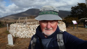
Featured image is of Greg on North Urambi Hill with an enhanced old stump
I led this walk with 6 walking on a nice winter’s day, with full sunshine and only mild winds.
5 of us met at the Shed by 8.30AM and then drove to a small car park on Learmonth Dr, just off Athllon Drive, Kambah in Tuggeranong. We didn’t get there until nearly 9.30AM as there was a multi-vehicle smash on the Tuggeranong Parkway just north of the Molonglo Bridge on the northward side. All the drivers heading south slowed to gawk, thus creating a long delayed line of traffic going south.
We met one more walker there, and from 9.28AM we walked down the nature reserve parallel to the fence, then down along the fence along some of Athllon Dr, then turned west & followed a small track down to Tuggeranong Ck. We then continued along the edge of the creek until we joined with the Murrumbidgee River track after about 600m. We then walked along this track for just under 2Km until we could turn north through grassland.

Then we followed a fence line up for 1.2Km past several dams until we met the BNT (Nat Horse Trail) just SE of Ferrier Place, Kambah. We then followed the BNT, and then a footpad over Mt Urambi and back to the cars. The climb up Urambi North peak and Urambi Peak was short and sharp. The track down from Urambi was very steep.
Views from the two peaks were superb giving near 360 degrees of scenery of the Murrumbidgee Valley, west to the Bindabella Mountains, north to Mt Coree, south to Mt Tennant as well as east to Mt Taylor, Isaacs Ridge and Tuggeranong suburbs, Lake Tuggeranong and Tuggeranong Town Centre.
We finished the walk at 12.29PM, thus taking some 3Hrs 1m.
This was a Medium walk with some climbing overall from the Murrumbidgee Trail at around 550m to Urambi Hills around 715m. Distance was 8.2Km.
There were numerous roos on the grasslands between Urambi Hills and the Murrumbidgee Trail.
3 of us did go for coffee at Lucky Shot Expresso Bar in Kippax, in Belconnen. This is a nice cafe with great coffee, burgers, & milk shakes. (Bob they are only $4 or $5).
Walkers: David Ruthven, Drew McDonald, John Edge, John Marsh, Peter Coppin, Greg Hutchison | Drivers: Drew McDonald, John Marsh, Greg H
Map of walk | More pictures in Google Photos | files including gps located in Google Drive
Notes re Maps: GPS map views provided using Garmin Mapsource with map base using OSM | The area of the walk is covered by the NSW 1:25,000 topo map TUGGERANONG. The area has a large number of foot tracks not shown on official maps.