2019 08 01 Yass River & Town Walk with MelbaShed
This was a 5.9Km walk taking 2hrs 15 mins around Yass and its River Gorge & Riverland Park. This was Melba Shed walk No 210. This was based on a recce walk of 9th July 2019.
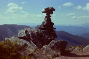
Featured image is of Greg on the Yass River in the Yass River Gorge area
I led this walk with 11 walking on a cool but sunny winter’s day.
We mostly met at the Shed in Melba, Canberra by 8.30AM and drove to Yass to park in the Rail Museum car park along Crago St. We did this by turning left at the second roundabout you come to entering Yass from the north. It was just near the Aldi supermarket.
Then from 9.32AM we walked down the Main St, called Comur St for 375m, then turned right into Meehan St, then walked along Meehan for 150m before turning left to visit the Banjo Patterson statue. Behind the park there were toilets on the left and a bubbler nearby.
We then walked down a concrete path through parkland, across Rossi St then further for 350m down to the path along the Yass River banks. Then we continued right for another 330m to Flat Rock Crossing area where we took a path on the right along the gorge. Yass Gorge which spans between Flat Rock Crossing and the Yass Dam which is the town’s water supply.
We then walked around 1.5Km along the gorge with the track getting rougher and vaguer as we approach the dam. After walking across a small gully we walked along a fence before reaching a gate through that fence and then we had to climb through another fence. The last part of the walk to reach the spot we could view the dam and its lake was easy walking over grassy land but required climbing 20-30m higher and edging along another fenceline near the crest of a ridge.

After viewing the dam itself and the lake behind, we back tracked & then went down, crossing the river on a causeway before we went through some more grass and scrub before reaching a bitumen road, at the junction of Mount & Hovell Sts. Near here several of the guys spoke to a man running an engineering business who did various jobs for farmers & even owners of old Rolls Royce cars in Canberra.
Then we returned back along the road & walked on a new path down to Flat Rock Crossing, taking 1.4km from the dam view. We then walked along the north-west bank of the river, under the road bridge & then up onto the railway line track & followed it all the way back to the cars for 1.8km by 11.47AM. There were some interesting old houses next to the path just before reaching Dutton St which took us back to the old Town Railway Station. We had climbed up the path adjacent to Riverbank Park and onto Dutton Street which contains the old railway line. Unfortunately the Rail River Bridge is blocked off as it a yard to the south west that contains several rail infrastucture items. The old town railway bridge and gas works, both of which we passed were built in 1892. The Yass Tram line they call it was opened as a light railway in 1892 and connected Yass Town Station to Yass Junction Station on the main Sydney -Melbourne line. Passenger services ceased in 1958 and the line was closed to all traffic in 1988.
After the walk 9 of us stopped for coffee etc at Kaffeine 2582 not far from Railway Museum Car Park.
After coffee 7 of us did a short extra drive (5.2Km return) out to Hume’s grave near the Cemetery as well as Thomas Laidlaw’s grave on Handley Pl (Riverview Est) as it also offers a great view over Yass.
We then drove out to Hamilton Hume’s Grave site at the cemetery which is on Irvine Street. Its about 2.5Km from the main street. I had to drive back down Comur St and turn left up Rossi St, then after 730m turn right onto Irvine Drive. Then we drove 1.2km down Irvine Drive and turned left to park next to an Electrical Sub-Station at the very northern end of the cemetery. There is an unlocked gate we entered and walked around 50m back up to the grave. The graves GPS details are : UTM 55 H 673304 6143654 or Lat (S) 34deg 50.080 min Lon Z(E) 148deg 53.716min. Here’s a bit from the ABC about restoration of Hovell’s grave at Goulburn
We also tried to visit Laidley’s grave site which was surrounded by a wooden picket fence, but were forced back by a pair of Plovers guarding their eggs lying on the grass near the grave. However views over central Yass Town from Handley Place are quite special.
This was a Medium walk with some climbing overall from 620m at the start to a max height of 710m. Distance was 5.9Km. We had started walking at 9.32AM and finished at 11.47AM, ie 2hrs 15m.
Walkers: Alan Smith, Bob Salmond, David Ruthven, Drew McDonald, Fitz, Geoff Grimmett, John Marsh, Paul Taylor, Peter Coppin, Roger Amos, Greg Hutchison | Drivers: Alan Smith, Roger Amos, John Marsh, David Ruthven
References: Refer to my Recce walk notes from 9th July 2019 | Yass Valley Visitor Information Centre documents on walks and drives around Yass | Yass Valley Town Drive | Yass Valley Town Walk | Yass Town Trail Guide (this is the most useful) | Munnagai Yerribi Trail
Map of walk | More detailed map along the gorge | More pictures in Google Photos | Files including gps located in Google Drive
Notes re Maps: GPS map views provided using Garmin Mapsource on an OZtopo Map base with permission of © BKK Enterprises Pty Ltd, http://www.gpsoz.com.au | The area of the walk is covered by the NSW 1:25,000 topo map YASS