2019 07 15 Harrison Walk Recce
6.6Km walk taking 1hr 34 mins checking out feasibility of an interesting walk between Harrison Playing Fields, along Old Wells Station Track, around Wells Station and through various parks and green routes within Harrison, Gungahlin, in Canberra, Australia
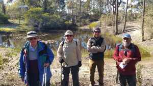
Featured image is of Pond near Gungaderra Ck, Harrison
This was a reconnaissance (i.e. a recce) walk around parts Harrison Playing Fields, along Old Wells Station Track, around Wells Station and through various parks and green routes within Harrison
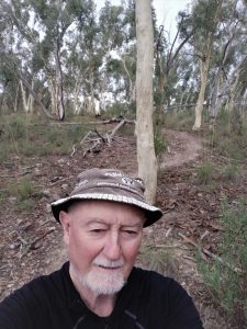
The day was cool with a slight breeze blowing. It was now winter with zero or below mornings. So I wore winter clothes with a polar fleece top covering, a scarf and a baseball cap.
I parked at a car park adjacent to Harrison Playing Fields 1 along Nullarbor St and close to Harrison Public school. I then headed south along the Old Wells Station track until I could head east at corner of the fences around Well Station property. Its a long slog around to the north-east before I could then head north-west around a hill where there is an old house on the top and into Adder St. I then took a laneway north and then into Mullion Park. Its a long interesting park that is roughly just over 500m long. It is festooned with signs each having a poem written by David Campbell. Davids’ biography. He was once an owner of Wells Station and who was an old Australian poet. The park also has some children playground items as well a dual electric BBQ facility and tables. At the north-west end there is a large pond, one of many that dot the path of Gungaderra Ck from Throsby down through Harrison, Franklin, then Kaleen & finally through Giralang before joining Ginninderra Ck.

I then turned north, then east before reaching the edge of Harrison, after which I walked near Horse Park Drive for nearly 500m before turning left & south-west down a path adjacent to Gungaderra Ck & past another pond and then the previous pond, before reaching Harrison Playing fields No2. I went across one large field and then south down along the western side of Harrison School which is a large modern ACT Government run school being some 350m from its north end to its south end.
I then walked a little south and into Flemington Rd to find the location of the Blind Dove Cafe which seemed the most suitable site for coffee in future walks. I then back tracked to where I had parked.
It was an interesting, relatively easy walk of 6.6Km taking around 1hr 34mins
The route was mostly on bushland dirt paths with some foot pads, some open woodland country, some town concrete paths and some grassy sections. There were no facilities, except a BBQ and some seats and no water available.
Map of the walk – overview | Map of the walk -detailed near Pond 2 | More pictures in Google Photos | files including gps located in Google Drive
Notes: GPS map view using Mapsource on a map base using OSM NSW Garmin Cycling Map | The area of the walk is covered by the NSW 1:25,000 topo map CANBERRA. However there has been so much development in the area not all the area is shown as developed on the current version of the map. Thus for practical purposes Open Street maps are better for planning walks in this area as they show the foot tracks much better.