2023 01 12 Latham Stepping Stones Social Walk with MelbaShed
Featured image – View of Stepping Stones in Umbagong Park, Latham
4 of us met at the Shed by 8AM. We walked across to Flynn & took little tracks through to where there was a large open area whence we turned south & went down under Ginninderra Drive to then take the path that follows Ginninderra Creek towards Latham & Kippax.
We stopped to visit the Aboriginal Grinding grooves area but most of the surrounds were heavily overgrown with high grass levels. We went back to the main trail then took the first bridge & walked along the west side of Ginninderra Ck. We then crossed two old condemned wooden bridges that should should have been replaced by now. The local Govt has been tardy so locals have ripped of the fences & it was thus easy to walk over them.
On the way we saw a cut path down to the creek so we ducked down to see the creek. It looks like a nice spot where maybe some come to fish? We then returned to the main path & continued to the Stepping Stones.
The creek was back to normal flow so there was no issue crossing the stones. We then took a path up to Latham shops & stopped for milk coffee drinks except for Bobs milk shake. Thanks Bob for shouting us.
We then headed east across Latham Oval & took some back streets through to Kingsford Smith Drive opposite Krefft St, Florey.
We continued along a path north past some nice deciduous trees to then go under Ginninderra Dr & up a little of Kingsford Smith Dr to turn right. We then had to walk east some 300m to be able to turn north & cross the new Icon sewer line to enter Melba properly.
We then took a lane up to Goldner Cct adjacent to John Edge’s place, but he wasn’t home. We continued up a lane & then back to the cars at the Shed car park.
It was an Easy walk of 6.7Km in 2hrs 40m
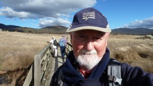
Walkers: Bob Salmond, Harry Angel, John Fuller. Greg Hutchison
Map of walk | Pictures in Google Photos | files including gps located in Google Drive
Notes re Map: GPS Map View provided using Garmin Mapsource on an OSM Map base. The area of the walk is covered by the NSW 1:25,000 topo map CANBERRA.


