2022 07 07 Molonglo Gorge with MelbaShed
This was an 8.6Km Medium walk in a loop up the Molonglo Gorge, near Queanbeyan, NSW although technically in the ACT. This was Melba Shed walk No 275 of 7th July 2022.
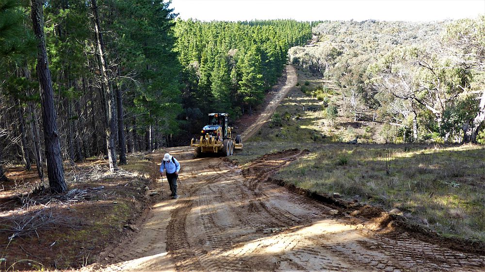
Featured image – Bob with Grader on Forest Road
I led this walk with 7 of us walking. 6 of us met at the Shed by 8.30AM & drove in 2 cars past the Airport on Pialligo Ave to the parking area at Molonglo Gorge Nature Reserve. It was a left turn onto Sutton Road for 1.4Km then turn right onto Kowen Road. Then after 600m a right onto a dirt & bitumen road for 1.1km to reach a picnic area & parking spot, where we met one more.
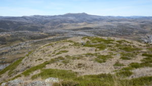
From around 9.15AM we took a track along the edge of the gorge overlooking the Molonglo River, 3.5Km out to the Blue Tiles Picnic Area where we had a 20min morning break. It was a well setup track with lots of rock steps, some hand rails & lots of views of the Gorge & the railway line to Sydney high up on the other side of the river.

On the return we went up forest roads north-west until we reached a major road that then took us around to the main entry road. The initial climb on the way back was quite draining. The 2nd hill climb was up a steeper section where we walked over recently graded section with the grader still working.
It was a Medium walk of 8.6Km, 3hrs 15m incl 20m of breaks. The two hill climbs on the return made most state it was harder than medium. There were some nice views along the gorge & if lucky we might have seen a train go along the track high on the other side of the gorge. We did catch sight of a small train going to Canberra and also heard it returning later although we did not get a good look.
4 of the guys stopped & waited as we reached the main bitumen entry road whilst the drivers continued on to pick up the cars & drive back to pick them up.
We left around 12.40PM to mostly head back to Canberra.
The weather had been sunny but cool in the gorge. On the way back it was warm as we trudged back on the forest roads.
Walkers: Adrian Fryatt, Bob Salmond, David Leach, Drew McDonald, John Fuller, Keith Thomas Greg Hutchison.
Drivers: John Fuller, Drew, Greg
Map of walk | Pictures in Google Photos | files including gps located in Google Drive
Notes re Map: GPS Map View provided using Garmin Mapsource on an Oztopo NSW topo Map base| The area of the walk is covered by the NSW 1:25,000 topo maps BUNGENDORE (mostly) and CANBERRA (a little bit).