2020 11 01 Four & Nine Mile Diggings & Nth Bloomfield (Kiandra 18)
This was a 4 day and a total of 53Km walking trip from Pollocks Gully, Kiandra to 9Mile Diggings, then back and down to Four Mile Creek Diggings. I also looked around areas of South Bloomfield and ended up walking right to the source of Bloomfield Creek. I also revisited North Bloomfield on the way back but it was only a quick visit looking for the Mint Hut.
This was all within Kosciuszko National Park just south of Kiandra along the Snowy Mountains Highway. This was a continuation of many similar trips to 4&9 Mile Diggings since 2011 and in particular my last trip Kiandra Trip 17 of 2-5 October, ie the previous month.
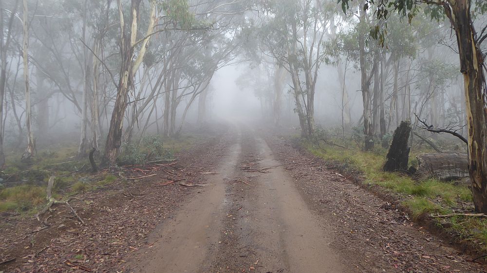
The featured image is a picture wild flowers growing on the Tabletop Trail near Four Mile Creek
More pictures on Google Photos
1 – 4 November 2020 – Four & Nine Mile Diggings & Nth Bloomfield (Kiandra Trip 18)
Purposes
The purposes of the trip were to check out more areas of 9Mile Diggings I didn’t see on my last visit as well as to find the source of another race that may have fed water to the South Bloomfield Rock Dam. I also planned to spend more time at 4 Mile Diggings as I didn’t give it enough attention last visit and lastly to check out some more sites at North Bloomfield. I also planned to recheck some things at Basalt Diggings, Giandarra and 12 Mile Diggings if I had time.
This trip was one of many over several years checking mining and other historical sites around Kiandra to help historian David Scott and ultimately Kosciuszko Huts Association (KHA) with documenting European historical activities within Kosciuszko National Park (KNP). In the process many hut and mining sites have been found, GPS’d and photographed.
This was a continuation of many previous trips to both 4Mile and 9M Diggings including Tabletop, Broken Dam, Elaine Mine and North & South Bloomfield Areas going back to around 2011.
Context and Conditions
I drove around 220Km from Canberra to Kiandra and was only able to park at Pollocks Gully just off the Snowy Mountains Highway. So I started from here late on the morning of 1st Nov in nice conditions.
Items of Interest
Some things I noticed on this trip, different to my earlier trip this year was the large amounts of wildflowers now evident all around as well as significant grass growth since early October. Also the flies were now out and march flies were also around.
1st Nov- Day 1
Wild Flowers.
On the way to 9Mile I quickly noticed the array of wildflowers now showing all the way along the Tabletop Trail. The flowers had grown quickly as in Oct there were none. Now they were everywhere and in some areas making recognition of sites harder by their coverage.
Nine Mile Creek Area
Day1 – 9Mile Dam 2 Race from Milkman’s Ck. I walked along the ridge between Milkman’s Ck and 9Mile Ck trying to take a shortcut to near Dam7/Site25 where I thought I could camp. Then I came upon a new race. I followed it east a bit and it ended up coming into the NW end of the west banana end of Dam 2.
I then went in a direct line for Dam7 and came upon a couple of sites:
9M Site 46. It’s a possible tent/hut site. It’s a dug out area with small dugout trench on its upper and sides. Some stones were at its top end.
9M Site 47. It’s a pile of rocks with a tree growing out of one side and also it’s close to a spring. It’s not very flat but could be a hut site
Day 1 – Revisited 9M Site 24. I continued towards Dam7 looking for a camp site and came upon this site again. It was now displaying lot of flowers. However the outline of a hut site is till viewable. Continuing across to the west I noticed a significant race coming down from Dam 4 I thought.

I then went to Site 25 and setup my tent. Not a perfect site but OK.
After I went back over to above Dam7 and followed the race and it went right to 9MSite 24 and finished nearby. I looked around and 30m or so downhill I found small dam that was nestled next to the main tail race outlet for the Long Sluice that started near GOLD Hut site. Dam 36. I then followed the race back over a gully and up through a lot of fallen burnt timber. The race came for the NE banana end of Dam4 which was a high point on the Dam. It wasn’t clear how water would leave the point where it joined the race. The dam would have had to be full for this to occur.
I then went from Dam4 uphill towards a saddle that would allow access through to Milkman’s Ck valley. I turned east instead and walked uphill to pick up the race that went around to Dam2. I then followed the race around into Milkman’s Ck valley. Coming into that valley the race was not far below a rocky cap on the ridgeline. I continued to follow it but it faded out. I looked around as most of the ground was bare and could not find any more signs of it. Looking at the map it’s hard to conceive where the race might have started. It’s possible it was never finished. A lot of the race was really a flat dirt track as rain had washed silt over the old race making it a flat path.
2nd Nov- Day 2
Around 9Mile. I went across 9Mile Ck and found a couple of possible sites in the middle of 9M Creek. It’s a wide open area with multiple parallel small gullies and lots of stones.
9M Site 48. It’s a possible tent site and fireplace. It’s a pile of stones with some grass flat areas nearby
9M Site 49. It’s a possible tent site and fireplace. It’s partially surrounded by some large stones and on the southern side the raised bank of the main creek. So it’s got water. There is also a lot of flat campable ground and many stones that could be used as seats around a fire.
I also revisited Dam 32 further south and noted that there were water races across to a creek and swampy area to the north east.
I walked up to the saddle to the south following the race and went around to just above Dam28 and the next creek down to Scott’s Gully below. I then found that races coming from Dam19 to Skeleton Ck and its Dam28 were as previously thought only around 1m apart.
9M Site 50. It’s a likely hut site and fireplace. This is actually inside Dam 21 but on some slightly raised land. As the scrub has been cleared out it’s possible to see that the area is more like a mini sluiced area and has a tail race at its bottom.
I looked further around Dam 22 close by and found a link from the aforementioned races to it. Thus there is a tap in the Race Dam19 to Dam28 that then flowed down into Dam22.
Scott’s Gully Water Falls

I went down the creek that develops below the Dams21/22 and associated diggings but took some open country to the east thus bypassing the junction of Scott’s Gully with this creek. In the process I got a great view over the waterfall and could see an old slightly benched in grass track that runs from a point on the creek around the hillside to the top of the falls. This gave me an easy route around to the top. I guess the miners must have cut it in many years ago but it must have been covered by scrub in the intervening years. The track doesn’t really continue above the falls but it was easy enough to clamber along the open slopes and even walk on the grassy edges of the gully.
9M Site 51. It’s a possible fireplace and camp site on grassy banks of the creek. 240m upstream there is a second set of falls or rapids although these are mostly just racing down a steep rock face. It’s easy to walk up the south side to the top.
Shortly after these falls there are further side gullies/creek, with the one to the west going up to near Dam19 and access to the main valley, whilst the one to the East just being a side creek. However on this one there is another Dam, 9M Dam 37. This dam is close to the junction with Scott’s Gully. Its centre has been breached.
I travelled up the other creek which climbs steeply but is easy now after the fires. From the top of ridge I looked across to the main Empress Sluice and could also see the likely mullock heap location for Lettes tunnels. These were all orange small piles of dirt. I went around to Bells Area and could pick out similar coloured piles of spoil. There are 4 assorted piles on the tunnel side of Scott’s Gully and one large on the other side.
Bell’s Tunnel Entrance looks more obvious now. There is a large stone in the entrance which I think has fallen as parts of the entrance eroded. I could see several more pieces of rail track lying around in the entrance area. If indeed the orange spool pile across Scott’s Gully is from this tunnel they must have bridged the gully with rail track to get the spoil over there.
I went north a little and then followed the obvious large race coming down the hill from above. Close to Dams 13/14 I came to an intersection with a race from the south-east. I followed it for just under 200m and found it sourced water from a creek that flowed down to Scott’s Gully but just below Dam24, previously found. I note another parallel race also collecting water from just below the Dam Wall. I followed this back and realise that it continued past the point I had started from and then continued around the same contour until it was close to the main Sluice. I followed another race that took me up to and into Dam14. I also went to Dam 13 which is slightly higher and adjacent. More races run from these dams down to the points below, I had started from.
I walked to just above Dam14 and lunched. I could also see 9M Site/Hut 15 which is a hut I had previously found. I used my compass to get bearings on this hut as I think I may have shown it incorrectly in the past. The hut has a traditional stone fireplace with a wide rectangular main section. This section is on alignment of 95deg mag. The slight protruding sides of the fireplace are on alignment 18deg mag (ie nearly North). The body of the hut is below the fireplace in a dug out area.
I then went across to Dam 13 and followed a creek up towards the Main Header Dam. This creek is really a race that comes from a South West exit high up on the Dam. There is also a race that comes from the Dam and heads North West to the edge of the Sluice.
Races from 9M Header Dam to Upper Scott’s Gully Diggings Gullies
I thought there were two of these races: one from Header Dam across the Tabletop Track around the contours then back across the Tabletop Track and then to the Gullies. This time I detected two races coming from the Header Dam and crossing the Tabletop Trail to the Gullies. No can’t be. But there are! I will redo previous versions of a sketch to outline this. The attached Sites spreadsheet shows some points on these races.
What is different is the race that comes from the Header Dam via a section of the Sluice that has collapsed provided a race that went alongside the Tabletop track without crossing it as well as having taps back to the Sluice edge, down to Dam 15 as well as further north to the Gullies. This same race from the main sluice edge has a tap that crossed the Tabletop Trail and went close to the eastern side of the Trail before recrossing the Trail before heading down to the Gullies.
I also revisited 9M Site 42. Which has two piles of rocks and is adjacent to the race that comes from the Main Sluice Edge past Dam 15, doesn’t cross the Tabletop Trail but goes to the same Gullies as the races mentioned above.
I also revisited the race that comes from the 9M Creek, turns right or south, crosses the Tabletop Trail and goes down to the Gullies crossing one of the other races.
Walking around the area between 9Mile Ck and the 9M Village I found several minor items:
9M Site 52. Just a couple of large tins lying in the dirt
9M Site 53. Just a bedframe and pot
9M Site 54. A gold panning dish lying on the ground next to the trail through the 9M Village area.

I looked for some other 9M Village sites but I had neglected to load David’s data. The Village area looked fairly empty of any interesting things. There are several nice flat spots and the odd possible trails with some stone edges
I also looked around the area between the saddle on the way down to Scott’s Gully. There are numerous piles of stones that may be sites for a hut or a tent etc. I had previously GPS’d 5-6 of them. I think there may be more possibilities. I was feeling a little heat exhausted so I did not pursue any of these.
3rd Nov- Day 3
I went across the 9Mile Ck valley from near Gold Hut site then up to 9M Site 45. I took several more pictures. The ground is dug out on the north side of the fireplace. The site is ~23 boot lengths long. So 6.9m long. Probably 3-4m wide.
Four Mile Creek Area
I headed up the trail and didn’t deviate until I reached the upper 4Mile Ck crossing from where a race goes around to the South Bloomfield Rock Dam. I walked further down and turned right away from the trail walking over mostly burnt ground. I was looking for any race coming from 4M Ck across to the 4M Sluice B area. Well I did not find any which was odd. So dumped my pack at the very south west end of the Sluice B. I then wandered around the edge heading east. I did find a faint race running around the edge of the Sluice, then I came to a well-worn out rut that ran into the Sluice. I suspected this might be the source of water and followed it up for around 250m. Boy was it steep. Races are not supposed to be vertical. It ended up in open bare land right at the 4M Swamp to Rock Dam Race again. That made that race much more important. But it was a steep run for water. There was an amazing view of the 4M valley from way up on this hill. I went back down and before the bottom I noticed a side race leaving this main run and I followed it down and around the edge of the Sluice but it petered out. I think it must have gone either to Dams4/5 or small gully between them and the main Sluice.
I then checked out races along the edge of the Sluice as well a route for a main race over behind the main sluice and I found one a bit like a track that came from a race coming down from a Trib Ck of Bloomfield Ck but also close to the race from 4M Ck to Bloomfield Rock Dam. This race crosses the Gold Commissioners Gully Trail and then drops down to the 4M Sluice Header Dam.
I also walked around Dam 4 and to Dam 5 which I now realise is more a sluice area than a dam and would thus not hold that much water. The totality of Dam 5 and a couple of small gullies, all back onto the 4M Sluice B and its Tail Race B.
I also walked from the Main 4M Header Dam and followed a race to the Sluice B and its walkable now back to the very SW corner.
There is also another race that goes across from the race from near Bloomfield Ck trib and to the top of the end of one of the Sluice B Gullies.
I need to revisit these later gullies and probably review sketches of this area. I think it’s a little clearer since the 2020 fires. (I did come back and rechecked around Sluice B In trip 19).
West of Sluice B and south of Dam4/5 is a nice flat grassy area where I found 4M Site 2 a Fireplace Poss Hut site. While there a lot of stones they are spread out. Nearby where I camped I later found another site also with spread out stones but covered with grassy creeper stuff. 4M Site 6 possible site near Dam4. Both looked like they might have been used in the past. There is a pile of broken glass just uphill behind a tree for Site 6.
Other sites found:-
4M Site 3 GH Fireplace & poss hut. Site found on embankment between 4M Sluice B Tailrace B and Dam 5 area. It’s a small pile of stone partially crushed by fallen burnt tree.
4M Site 4 Poss Fireplace GH. Found on an area between ck and just above Lower Race near Dam 12 location and rocky way that carries the race. It’s one of the Bloomfield Rocky Dam races.
4M Site 5 Likely Fireplace next to race Xg Ck. This is another small area of stones but right next to a prominent race as it comes down from a Bloomfield Ck trib and heads down to the 4M Sluice Header Dam and 4M Sluice B area.
On the afternoon of Day 3, I followed race from the Header Dam that came from the Bloomfield Ck trib near Bloomfield Sluice. I then climbed up creek sides to the Bloomfield Races above. I was lucky enough walking up a creek above the races to pick up another race that came from Bloomfield Ck proper but way up near its source. I had crossed this race last trip coming down to the Bloomfield Rock Dam. I then followed this new race along its contour south to Bloomfield Ck itself which was a slow process over its 1.1Km length as it was still well vegetated in places and numerous dead trees had fallen down across it. At the end of the benched race at Bloomfield Ck there was a long drop down to the creek. I guess that the old race had continued up until it reached the creek but its alignment had been washed away over the years. It’s probably been nearly 120 years. I came back over the tops looking for sites. I even came down part of the CGT which itself is impacted by a lot of large fallen burnt trees.
I had a hard night camped just above Dam 4 in a nice large open space but totally saturated with flies and insects.

4th Nov- Day 4
Started out looking around my campsite and found one site. I noted the day looked less than perfect so I decided to go home for sure, and I did.
I crossed over 4Mile Ck to the west bank and climbed up and quickly found 4M Site 7 GH (DS/PK MinersHut #6) This can clearly be seen as a hut site with a large pile of stones in the fireplace design with a shovel head, wire and broken glass around and its located between two races.
I then dropped down and headed north and quickly I came upon several mounds that looked like the 4M Village concept. I was able to take pictures and gps’d around 5 sites 4M Site 8 through to 4M Site 12. The latter had rocks and glass nearby. I realised at the end that this was the Village although I initially expected it to be further north.
I went north and though the large Main Dam and then down the creek that flows north into a Trib Ck of 4Mile looking for Taylors hut. I found one possible site 4M Site 13. It’s a mound with dug out ground behind and uphill slightly. There was some rusty metal nearby.
I then went on a loop down the creek crossing first to the east side. I did find a nice small rock wall which I noted as 4M Site 14. I assume that the wall was only for protection from the wind so it’s unlikely to have been a hut site. I eventually crossed the creek and headed back along the north-west side and I came across a real hut site 4M Site 15 (DS/PK Miners Hut #2).
I imagine if I had time looking further down to the junction of 4M Ck and maybe further down it there may be more sites.
I then went around the area between the side ck and 4M Hut area and it’s been burnt out to bare earth but I could see nothing.
North Bloomfield Area
After a quick lunch I went up the Tabletop Trail stopping at North Bloomfield to check out the main race and look for the Mint Hut site which I did not find. I noted a race going north east and downhill from around David Scot’s spot for the Mint House. It might be fruitful to follow it in the future and look downhill towards 4M Ck proper.
I returned to my pack and reached Kiandra around 3PM. The weather was looking bad and it started spitting a little.
After I got home a policeman from Jindabyne rang my mobile in Canberra and asked for me. My car had been reported as abandoned at Kiandra although I did leave a note in the car of my expected return. I must admit I hadn’t put my name and phone on the note just a line saying back by 4th or 5th Nov. There were some workmen along the Snowy Mountains Highway near where I parked fixing the edges of the road and I assume they had contacted the police. I guess this reinforces the need to leave a sensible note on the dash at such locations.
Diagrams, Pictures and Docs Available
Pictures are labelled and grouped into bundles for each area i.e., 4Mile Area, 9Mile Area, BloomfieldNorth, Miscellaneous.
Documents
All document, gps and sketch files are on Google Drive
GPX Files – There is one gpx file:
- Kiandra 18 Nov20.gpx which covers all my trip.
Sketches – I did two manual sketches based on gps data and visual observation
An updated sketch map of races between 9M Header Dam and Upper Scott’s Gully diggings and also an updated sketch map of 4M Sluice B and its relations with 4Mile & Bloomfield Ck and tribs
- 2020-11-18 9Mile Diggings Header Dam to Dams 15,16,25,26 Sketch
- 2020-11-21 9Mile Diggings Header Dam down to Bells Diggings Dams & Races
Each has a jpg and pdf version
Excel Files -There is one xlsx file:
- Kiandra 18 Nov2020 Sites.xlsx
Trip Maps
I did not create any topo day or feature gps maps using the gps data
WordPress Post categories and tags:
- Post Categories: Kosciuszko NP, Kiandra Walks, Mining, Mountains, NSW, Huts, AAWT
- Post Tags: Tabletop Trail, Pollocks Gully, Wolgal Hut, Pattinson’s Hut, Gold Hut site, North Bloomfield, South Bloomfield, 4 Mile Diggings, 9 Mile Diggings, South Bloomfield Rock Dam, Scott’s Gully, Upper Scott’s Gully, 4 Mile Creek. 9Mile Creek, Empress Sluice, 4Mile Sluice, 4M Sluice B, Bloomfield Ck
Happy exploring in these areas. It’s certainly not normal bushwalking.
Greg Hutchison, 12 Nov 2020 Updated 23 Jan 2021