2019 08 07 Urambi Hills Murrumbidgee Gleneagles
This was a 12.2Km walk around Urambi Hills Nature Reserve in Tuggeranong area of Canberra to see if its a viable walk for Melba (Mens) Shed. I also walked part of the Murrumbidgee River Trail and the Bicentennial National Trail next to Gleneagles Estate
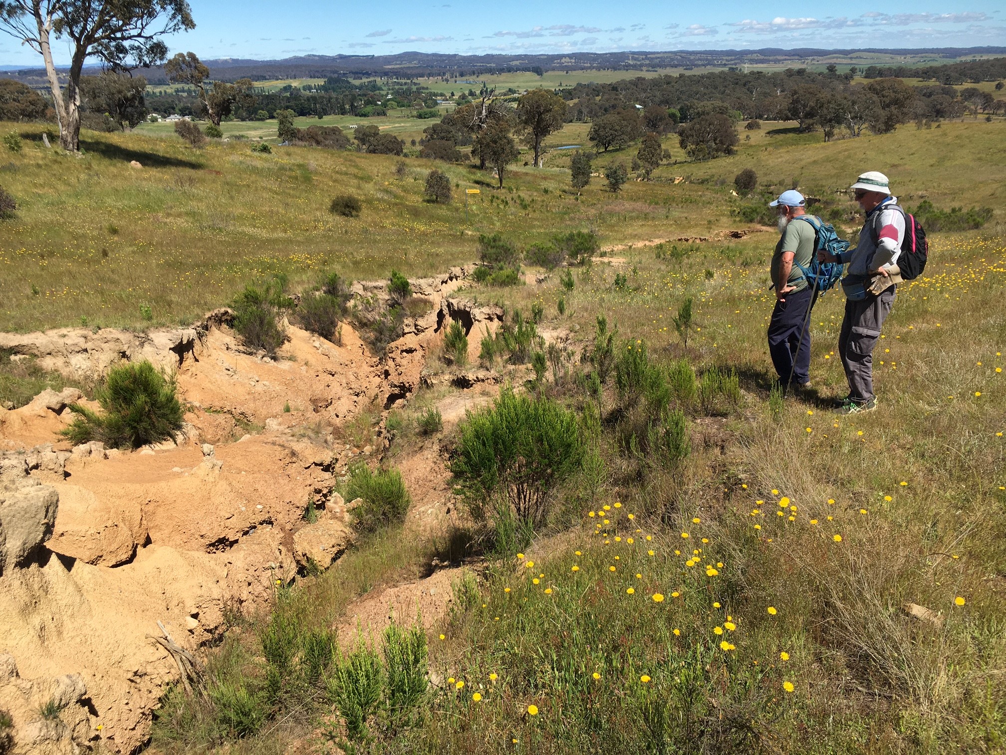
Featured image is a view of Greg in front of cliffs along Murrumbidgee River
This was a reconnaissance (i.e. a recce) walk around parts of Urambi Hills Nature Reserve, as well as some of Bullen NR, along some of the Murrumbidgee River Discovery Trail (I call it the Murrumbidgee River Trail), also along some of the Kambah Pool Road which is bitumen, however there is dirt cycle path off road along the southern edge of the bitumen road. The route I took also uses part of the Bicentennial National Trail (BNT) adjacent to Gleneagles Estate and along the eastern edge of Urambi NR.
The day was cool with some sunshine and with a slight breeze blowing. Being mid winter I wore winter clothes with a heavy jacket as my top covering plus a beanie. When I started it was cool (my car said it was 0C at 9.30AM) but when I finished around 1.30PM I was sweating a bit and was dehydrated.
I started the walk at 10.16AM and finished at 1.31PM. Thus taking around 3hrs 15mins excluding lunch. However I was checking things and gps’d many points as well as stopping and talking to two different guys from Gleneagles, Estate Mitch who was on sick leave and an older gent with a dog called Baz.
I initially headed north along the trail, going through several gates and swinging west and then north west on various trails until I reached the SW corner of Gleneagles where there was a gate, G42 that allowed me to head in a southerly direction. I think this was private land. I continued downhill passing more gates, G43, then G44/G45, and G48 before reaching two gates G49 & G39 where I joined the Murrumbidgee Walking Trail. I was going to go south and replicate another walk I had done, but since I had done it I decided to go north and find the way back to Gleneagles Corner and maybe use that as a future walk for Melba Shed. From this point I started to get views of cliffs along the river the best is known as Red Rocks Gorge.
I went overall about 3.7km along the track before I reached Kambah Pool Road. On the way I went off track to view more of the Red Rocks Gorge although I didn’t go to the unofficial viewing spot but we will go to that in any future walk. It was slow going with the deviation and quite a lot of bridges and open gates that I went through.
From Kambah Pool I simple went up the southern side of the road along a foot pad or cycle dirt rut until I reached a spot which was marked as the BNT. On the way I had noted a gate for a Powerline and another marked as Bullen Range NR. I surmised that this later gate might be a shortcut back to the Murrumbidgee walking track and I had this confirmed by the man I met near Gleneagles. This route might save around 1.7Km in any future walk.
I followed the BNT back past where I had left the trail before at G42 and then went back up to point J7 (ie Junction no 7) where I turned left and went up east to a Gate G26 which had a label on it ‘Sally’s Run’ which I didn’t go through but turned south through Gates 28 & 29 before reaching my last gate G30. Outside this spot there is a large grassy area which could be used as a parking spot and its right at the junction of Meredith Circuit & Learmonth Drive. Near the gate was sign titled “The battling farmer of Urambi” which tells the story of Gerald Sheehan & his family who had moved here from Harden in 1926. The property was resumed in 1977. I finished by walking back up Meredith Circuit for around 500m.
It was an interesting, relatively successful medium walk of 12.2Km.
The route was mostly on 4WD management trails and built walking and cycling trails as well as some open grassland. Most of the walk was suitable for inexperienced walkers. However along the Murrumbidgee Trail there were many twists and turns and small uphill sections over rocky ground as well as soil conservation bumps.
Map of the walk | More pictures in Google Photos | Files including gps located in Google Drive
Notes: GPS map views using Mapsource on a map base using OZtopo Map with permission of © BKK Enterprises Pty Ltd, http://www.gpsoz.com.au | The area of the walk is covered by the NSW 1:25,000 topo map TUGGERANONG.