2020 07 09 Pine Is South Mt Stranger Point Hut with MelbaShed
This was a 9.2Km walk from a Car Park on the edge of Pine Island entry near Tuggeranong Town Centre, Canberra to Mt Stranger near Bonython & Point Hut as well as along the Murrumbidgee walking trail from Point Hut to Pine Island South. This was Melba Shed walk No 233 on 9th July 2020.
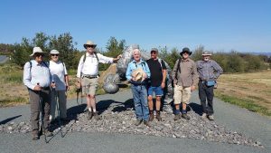
Featured image – Walkers on Mt Stranger
7 walked. 5 met at the Shed and drove to Pine Is car park where we met 2 more. We had to park near the entry to Pine Island North as the road to Pine is South was locked. When we met at Melba it was covered with heavy fog but by the time we got to Tuggeranong it was clear and sunny, but cold. The max for the day was supposed to be around 11C.
We started at 9.15 by walking back up the entry road for 130m before turning south on a dirt road, although we got sided tracked a little by several dirt bike trails. We reached the pond wall for Stranger Pond, then walked along its south side for 400m before turning south to walk through a small section of Bonython.
We then took a small laneway out to the Bicentennial National Trail (BNT) & followed it south for around 700m before we could turn easterly to walk up a winding fire trail towards the top of Mt Stranger. For the last 200m we went over open ground to reach Mt Stranger Trig station which offered great views north over Tuggeranong Town Centre & up to Mt Taylor as well as views over the Murrumbidgee valley & down to Mt Tennant & across to the peaks on the Tidbinbilla Range, etc.

From the top we took a ridgeline down to the south dropping off to the west to pick up the BNT again before turning down fenceline trails parallel to Woodcock Drive. We then went through a gate into the Point Hut dog exercise area before following paths and a fence to go through a gate to pick up the Murrumbidge River walking trail that took us to Point Hut Crossing reserve where we took a break and were educated by Ian on the various Pin Oak, Algerian Oak, Plane trees, etc.
We then returned back to the cars along that same river trail reaching the cars at around 12.19pm.
Overall an Easy-Medium, 9.2Km walk taking 3hrs 4m.
Walkers: Bob Salmond, Drew McDonald, Ian de Plater, Neville Viney, Evan Tully, Boyd Blackwell, Greg Hutchison
Drivers: Ian de Plater, Boyd Blackwell
Map of walk | More pictures in Google Photos | files including gps located in Google Drive
Notes re Map: GPS map views on map base using open source Open Street Maps (OSM) NSW Garmin map using Garmin Basecamp | The area of the walk is covered by the NSW 1:25,000 topo map TUGGERANONG